Roaming the Depths: The Role of Autonomous Assets in the EXPORTS Campaign

By Shawnee Traylor, PhD student in the joint Massachusetts Institute of Technology and Woods Hole Oceanographic Institution program in Chemical Oceanography / NORTHERN ATLANTIC OCEAN /

Satellites have undoubtedly opened up new ways for scientists to study the ocean, giving us global coverage of the surface of the ocean without ever having to step foot on a ship. But how can we learn what lies beneath the surface?

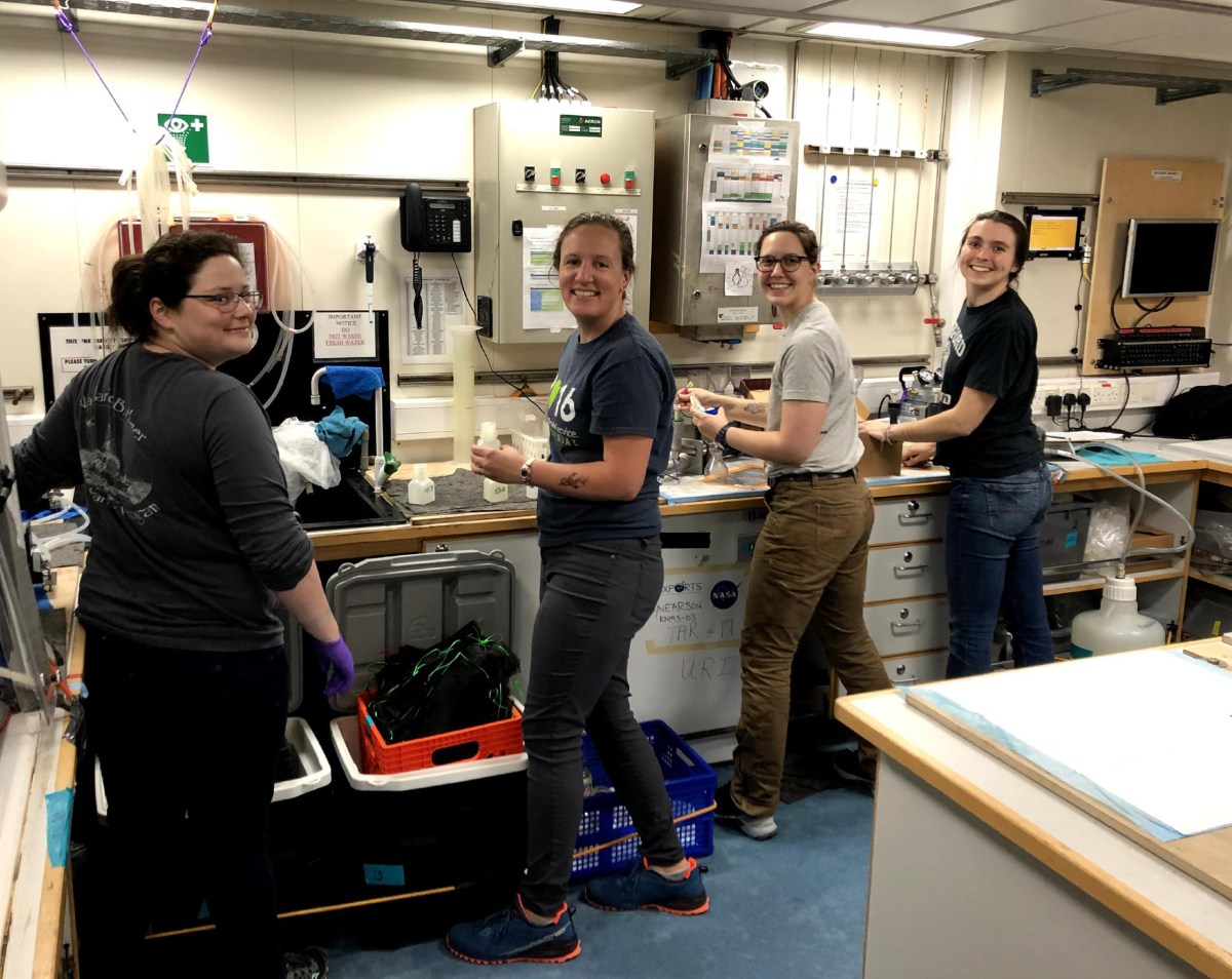
The classic way oceanographers study the ocean is, of course, going there. But putting together a cruise is no easy feat. They take years of planning, preparation, and enormous teams of scientists, mariners, and logistics personnel to bring to fruition. Once aboard, teams must adapt to perform delicate tasks under the demanding conditions of working at sea. Some cruises (such as this one!) run into storm after storm, which limits the ability to conduct our ship-based scientific missions.

One of the seagliders deployed on DY130, the cruise immediately prior to ours, which helped us scout features ahead of the ship and make informed decisions about where to sample.
One of the seagliders deployed on DY130, the cruise immediately prior to ours, which helped us scout features ahead of the ship and make informed decisions about where to sample. Credit: Filipa Carvalho, National Oceanography Centre

The difficulty of science at sea has been one driving factor in the development of autonomous platforms for use in scientific research. The wide range of platforms allow us to study places and timescales that are inaccessible to ships–such as the physics of water under ice sheets, or the interannual variability of biogeochemical cycles now and into the future.

The EXPORTS campaign utilizes a range of autonomous assets to collect data over time and space, and at different depths. Gliders silently soar through the water to waypoints provided by pilots on land, collecting measurements down to 3,281 feet (1000 meters) several times a day. Autonomous floats such as the Biogeochemical Argo float shown in the photo below remain in the ocean for up to five years, gathering critical data as they drift in the ocean’s currents. Drifters deployed at the surface give insight to the upper ocean currents. Like satellite imagery, these assets allow us to make informed decisions while at sea by scouting out the biology, chemistry, and physics of a region without having to move the ship. The assets that remain in the water after the cruise continue our study and give further context to our ship-based measurements.

Shawnee with a BioArgo float on the back deck, immediately prior to deployment. Credit: Leah Johnson, Brown University

Each type of platform carries a unique sensor package, though most of them measure temperature, salinity, and depth. The floats and gliders utilized in the EXPORTS cruise also include a suite of biogeochemical sensors that measure oxygen, bio-optics, and nitrate. The bio-optical package measures things like chlorophyll, a proxy for the abundance of phytoplankton, and backscatter, which is used to study particles in the water that may be important to carbon export.

On this cruise, I was tasked with deploying two BiogeochemicalArgo floats, to both inform our mission while at sea and enable us to continue our study of the region after we return home. Similar to gliders, these floats move through the water column by finely tuning their buoyancy by moving mineral oil between internal and external bladders. When it is time to take measurements, they sink down to 6,561 feet (2,000 meters) and begin gathering data on their way to the surface, constructing a profile of the water’s properties. Once at the surface, they transmit this data back to servers on land via satellite, who process and send it back to the team on the ship.

Two BioArgo floats running through post-shipment checks on the deck of the RRS Discovery. Credit: Shawnee Traylor, MIT/Woods Hole Oceanographic Institution

We deployed the floats in the first few days of the cruise, transiting over the first drop point at 4:30 AM. The brisk early morning air stole any lasting grogginess from my eyes as I grabbed a drill and opened their wooden crates. I hooked two alligator clips onto the head of the float and successfully made communication, waking it from its slumber. After a few final pre-deployment checks, it was the moment of truth. My fingers hovered above the keyboard, ripe with the responsibility of ensuring a successful deployment. One final keystroke activated the float, and it was time to release it into the vast black waves. How I wished for a blinking light, the purr of a motor, or any sign of life. But it stood silent. I had to trust that once we released it overboard, it would rise once again.

Imaging the Ocean

By Laetitia Drago, PhD student at Sorbonne Université / NORTHERN ATLANTIC OCEAN /

As a child, I used to spend my summers on the rocks near the water in Villefranche-sur-mer, France, my hands busy with a bucket and a small net. I was fascinated by the organisms surrounding me both on the rocks and in the water. Little did I know that I would have the chance to explore the open ocean with a bigger hand net, and multiple imaging instruments on a 231 foot (70.5 meter) long vessel.

Plankton net with 20 meter mesh size on the deck of the Sarmiento de Gamboa ship.
Plankton net with 20 meter mesh size on the deck of the Sarmiento de Gamboa ship (left) and the ship itself (right). Credit: Laetitia Drago

I started my PhD in October at IMEV in Villefranche-sur-mer, France, on the impact of zooplankton on the biological carbon pump through an in-situ imaging approach. It’s in this context that I had the privilege to join this impressive EXPORTS campaign onboard the Sarmiento de Gamboa research vessel. This vessel’s scientific team consisted mostly of people coming from the Woods Hole Oceanographic Institute, researching the ocean twilight zone, the layer of water between 656 and 3,280 feet (200 and 1,000 meters) below the surface of the global ocean. It is a very important layer of the ocean for the biological carbon pump, the process which is at the core of my PhD.

 The biological carbon pump moves carbon from the surface to the intermediate and deep oceans. This process starts at the surface of the water where small plantlike organisms called phytoplankton do photosynthesis, the process of using light to transform carbon dioxide into organic matter. This phytoplankton is then eaten by zooplankton, which transfer the carbon from the surface to the intermediate and deep oceans through multiple processes such as producing fecal pellets and daily migration up and down throughout the ocean. These organisms constitute an important source of food for fish, making them an important link in the food webs supporting fisheries all around the world.

 To look more closely at the ocean twilight zone, I brought imaging instruments to observe which organisms live in this layer. These included Underwater Vision Profilers (UVP). These instruments were developed in my lab in order to study large particles and zooplankton up to nearly 20,000 feet (6000 meters) in depth! The instrument counts and measures particles greater than 0.1 millimeters and saves images of the ones greater than 0.6 millimeters because those are the ones with a clear enough resolution to determine which taxonomic group we’re looking at. To do that, it uses a camera and a dedicated red light flashing system. On the image of the UVP6 you can see that there is a light. It can flash every few  seconds depending on how you program the instrument. For the UVP6 for example, it was programmed to flash once every two seconds. This way, it illuminated a volume of water every two seconds below the camera, which can then take a picture of the illuminated field of view.

The UVP5 has already performed more than 10,000 profiles in the ocean throughout the 10 years since its creation. It has been used in all the oceans fixed on CTD rosettes like the one used during this cruise. CTD rosettes are submerged in the ocean to measure temperature, depth and salinity in the ocean.

Deployment of the CTD frame containing the UVP5 and Niskin bottles. Credit: Laetitia Drago

I also used two UVP6s, a more versatile, small and powerful version of the instrument. Each one was in a cage, fixed to a drifting line which was deployed at sea. We hope that the images taken by these two instruments will help improve our knowledge of the biological carbon pump.

UVP6 in its cage (left) and during the deployment (right). Credit: Laetitia Drago

I also brought with me a Planktoscope. This microscope platform was designed at Stanford University by Plankton Planet and the Prakash Lab in the context of frugal science, which aims to bring science to the maximum number of people. It can be customized, redesigned and mounted aboard a ship by anyone in the world at a very affordable price!

Using a net or the water from the Niskin bottles (as seen in the second picture), I imaged the organisms living in the water and watched as the composition of organisms changed between the different parts of the ocean that we sampled.

Planktoscope imaging a sample collected with the net. Credit: Marley Parker and Laetitia Drago

Here a few images acquired by these instruments:

From left to right: Copepod (UVP6), Fish (UVP6), Shrimp (UVP5), Radiolarian (UVP5), Copepod nauplii (Planktoscope), Thalassionema diatom chain (Planktoscope). Credits: Laetitia Drago

As you might know, this journey was not an easy one. Three storms came our way during our mission at the PAP site. Nevertheless, we managed to do 11 profiles with the UVP5 and get six and a half days of images from each UVP6 with one image every two seconds. This amounts to around 148,500 vignettes for the UVP5, 323,000 vignettes for the UVP6 and 79,200 vignettes for the Planktoscope. 

The storms were unfortunate for our life on board and the conditions which stopped us from sampling during half of our presence at the PAP site. However, it was fortunate in the sense that we have a unique dataset containing data before the first storm as well as data between the three storms. This will hopefully give us an idea on the potential impacts that one or multiple storms can have on zooplankton and particle flux.

Our hard work was of course rewarded by the data acquired but also by a wonderful sunrise at the end of a very long last night of sampling followed by a 15 minute visit from a group of common dolphins on our way back to Vigo.

Sunrise on the Sarmiento de Gamboa.Credit: Laetitia Drago
Common dolphins. Credit: Laetitia Drago

Finally, I want to deeply thank the team in Villefranche-sur-mer, France, who trusted me with handling the instruments and supported me from afar as well as the very motivated team of scientists and the ship’s crew support who helped us acquire very important data which will hopefully help us to understand a little bit more the carbon processes at hand in the ocean twilight zone.

Making Plankton into Art

By Mikayla Cote, Master’s student at the University of Rhode Island / UNITED KINGDOM /

After flying to the United Kingdom, the EXPORTS scientists were in quarantine for two weeks prior to embarking on a month-long research cruise. While there was still some last-minute work to be done before departure, for most of us this meant there would be no shortage of free time spent alone in our hotel rooms. As one of the lab mates cheering on the sailors from home, I wanted to be a part of the effort to facilitate remote activities as they anticipated their month at sea.

Cynthia Beth Rubin, an artist who has been working with our plankton ecology lab for over a decade, began offering her plankton drawing workshops over Zoom earlier on in the pandemic.

An example of ecology art from the Zoom class.
An example of ecology art from the Zoom class. Credit: Cynthia Beth Rubin, artist. https://cbrubin.net/index.html

The plankton we study in our lab are microscopic plant-like and animal-like organisms, so Cynthia’s workshop aims to enable us to see and even feel these organisms’ movement through drawing since most do not know what microscopic plankton look like.  While EXPORTS researchers have an idea of what these creatures look like thanks to microscopes, many in the general public don’t. Through Cynthia’s class, people are getting to see what plankton look like for the first time. 

 Many of those in isolation did not have access to paper typically used for drawing in their rooms, but it did not matter: lined paper, sticky notes, and even napkins were just fine. One of the postdocs in our lab decorated the hotel room T.V. with her sticky note drawings to enjoy for the rest of her time there. My favorite part of the workshop was holding up our finished drawings in front of our cameras to share with the group.

The EXPORTS team showing off their artistic talents during their quarantine.  Credit: Susan Menden-Deuer
The EXPORTS team showing off their artistic talents during their quarantine. Credit: Susan Menden-Deuer

We spent a few hours together and while I cannot say exactly how those felt in isolation far away from home, this workshop offered a release to loosely draw and share sketches with others as well as a brief distraction from the global pandemic.

Caption: The EXPORTS team showing off their artistic talents during their quarantine.  Credit: Susan Menden-Deuer
Caption: The EXPORTS team showing off their artistic talents during their quarantine.
Credit: Susan Menden-Deuer

Small Bugs With a Big Impact

By Diana Fontaine, Ph.D. Candidate at the University of Rhode Island Graduate School of Oceanography / NORTHERN ATLANTIC OCEAN /

We have about one more week of full science fun left in the North Atlantic NASA EXPORTS campaign. It has certainly been a wild ride at sea given that we’ve experienced about four storms to date. However, even with the weather days, we have still accomplished an impressive amount of science.

My name is Diana Fontaine and I have been working with team grazer, alongside Heather McNair (post-doctoral researcher), Laura Holland (post-doctoral researcher) and Erin Jones (Ph.D. student). Our role in the project is to quantify microzooplankton grazing on phytoplankton. Microzooplankton are single-celled organisms that play an important role in the transfer of energy in the ocean. They are a key link between phytoplankton, the free-floating plants and algae of the sea, and larger zooplankton. Many species of zooplankton eat phytoplankton, which transfers energy to higher trophic levels. Every day, microzooplankton eat about 70 percent of the daily phytoplankton growth in the ocean. This is quite a huge loss factor of phytoplankton! Thus, understanding microzooplankton grazing rates has large ecological importance for carbon cycling in the ocean.

Fontaine and her team at work
Fontaine and her team at work. Credit: Diana Fontaine

Measuring microzooplankton grazing involves many, many hours of pouring water and filtering. Sometimes I feel like all we do is pour water from one place to another. But so it goes as a plankton ecologist! The basis of these rates comes from measuring chlorophyll, a green pigment in phytoplankton cells that is used in photosynthesis, at the beginning and end of incubation experiments. But first we must collect the water used in our experiments from the CTD Rosette, a device that we use to measure seawater properties like conductivity, temperature and depth as well as collect seawater samples. After collection, we incubate the water in tanks on the back deck of the ship. These tanks are covered in various layers of mesh screens to imitate the light levels at different depths in the ocean. The microzooplankton hang out in the tanks for about 24 hours to give the microzooplankton a chance to have a feast on the growing phytoplankton. 

A sunset on the water, taken from the EXPORTS boat.
Enjoying sunsets while on the EXPORTS campaign. Credit: Diana Fontaine

Once time is up for the experiment, we again filter more water – this time to observe how much chlorophyll increased or decreased during the incubation. There are some details to these experiments that I won’t describe here. However, overall if chlorophyll increased during the incubation, then there was more phytoplankton growth than the  microzooplankton were able to graze. And vice versa – if there is less chlorophyll at the end of the incubation, then that mighty microzooplankton had quite the snack! On some days we have observed happy snack time for the microzooplankton,while on others there didn’t seem to be much grazing happening at certain depths in the water column. We’re looking forward to examining these rates in greater detail once back on land.  

Instruments aboard the EXPORTS boat prepare to deploy.
Getting ready to conduct experiments. Credit: Diana Fontaine

For the remainder of the cruise, we plan to carry out a couple more grazing experiments. Both the length of this cruise and the periodic storms have allowed us to collect data under varying environmental conditions. This will make for an exciting data analysis adventure, especially when we place our results in the framework of the broader NASA EXPORTS project. 

Once this next week of science is complete, we will pack up all of our gear and samples for shipment back to the United States. While it will be sad to leave our floating home for the past month or so, I look forward to the data analysis, collaboration, and writing up our results back on land. Throughout this whole experience, we have been incredibly lucky to have the helpful support of the NASA Project Office as we navigated the traveling, quarantining, and sailing during the pandemic. It has certainly been a rewarding experience to join along for the ride. 

The Effects of Nutrient and Light on Phytoplankton Communities: Implications for Carbon Export

By Delfina Navarro-Estrada and Shannon Burns, oceanography graduate students at the University of South Florida / NORTH ATLANTIC OCEAN /

In the sunlit portion of the ocean exist single-celled microscopic organisms called phytoplankton. They are called the ‘grass of the sea’ because these tiny plants and algae perform many of the same ecological functions as plants on land. As such, they provide energy to the organisms higher up in the food chain that feed on them, forming the foundation of many marine food webs. Through a process called photosynthesis, phytoplankton also remove carbon dioxide from the atmosphere and use it to produce sugars and other organic compounds that they require to live and grow.

Trace metal clean sampling bottles lined up like little soldiers, ready to be deployed on rosette for collection of water from different depths.
Trace metal clean sampling bottles lined up like little soldiers, ready to be deployed on rosette for collection of water from different depths. Credit: Delfina Navarro-Estrada

Because photosynthesis requires sunlight, phytoplankton thrive in the surface layer of the ocean. Eventually some of the carbon in phytoplankton is exported out of the sunlit surface layer to deeper waters where it can become sequestered from the atmosphere for decades to centuries. Export occurs through different mechanisms, including when organisms that get their carbon from eating phytoplankton die and sink, or produce fecal pellets that sink. Most of the sinking carbon ends up being dissolved back into the water column before ever reaching the deep sea or the seafloor. The small fraction of organic carbon that does reach the seafloor, however, ends up being buried and stored for hundreds of thousands of years. This process of carbon export is known as the biological carbon pump.

Incubation set up. In each of these bottles samples of water, brought from different depths, different micro- and macro-nutrients are added to study the response of the phytoplankton community.  Credit: Delfina Navarro-Estrada
Incubation set up. In each of these bottles samples of water, brought from different depths, different micro- and macro-nutrients are added to study the response of the phytoplankton community. Credit: Delfina Navarro-Estrada

Net primary production is a term used to describe how much carbon the phytoplankton community incorporates into their cells via photosynthesis, minus the amount of carbon released through respiration. It can be limited by the supply of nutrients and sunlight in the water column, both of which vary over space and time across the ocean. Those needed in large amounts like phosphate, nitrate, and silicic acid, are called macronutrients . Other nutrients are needed in comparatively smaller amounts and are called micronutrients, which include many trace metals like manganese, iron, cobalt, nickel, copper, zinc, and cadmium.

Phytoplankton are so good at gathering required nutrients from seawater that they can run out. When that happens, their growth is slowed or stops and their composition changes in ways that affect export. They can become sticky, aggregate and sink quickly, or become poor food sources for their predators, reducing grazing and the amount of export by zooplankton that eat phytoplankton and produce fecal pellets. In these ways and others, the nutritional status of the phytoplankton can change how efficiently the biological pump moves carbon from the surface ocean to the deep sea.

As part of the EXPORTS program, we are identifying how macronutrient and micronutrient availability affects phytoplankton community composition and their physiological state to understand how these factors drive phytoplankton carbon through the biological pump.

In 2018, our team sailed in the North Pacific, a region with highly stratified waters with minimal nutrient input. Now in 2021, our team is sailing in the North Atlantic, a seasonally stratified region where eddies move nutrients from the ocean depths to the surface through a process called upwelling. We are using a combination of ultra-clean trace metal chemistry combined with the tools of molecular biology to understand how phytoplankton are responding to the changes in nutrients in their environments. 

Our team is trying to understand how different organisms respond to the changing nutrients? Working with the rest of the EXPORTS science team, we will combine measurements of carbon export, and ultimately the amount of carbon dioxide sequestered from the atmosphere.


Our Three “Hour” Tour

By Ken Buesseler, Woods Hole Oceanographic Institution /NORTHERN ATLANTIC OCEAN/

For those of us who grew up watching Gilligan’s Island, we all know the fateful story of the “three-hour tour.”  Well, as this oceanographer knows, that TV storm is not that different from the weather we are facing out here in the North Atlantic on the research vessel Sarmiento de Gamboa.

An aerial view of the R/V Sarmiento de Gamboa (foreground), positioned close to the RRS James Cook (middle) and RRS Discovery (back) at a meet up point in the northeast Atlantic. Credit: Marley Parker

Our story takes significantly longer than three hours, as we set off at the beginning of this month on a three-week tour – 18 days to be more exact. Add in three years of planning the science mission, plus two years of coordinating three research vessels to rendezvous at the same time and location, one year of COVID-related delays, two weeks of quarantine in a hotel in Vigo, Spain, and you get the idea of how much time and effort we expended before we even left the dock.

Our mission is to gain a better understanding of the mysteries of the ocean’s twilight zone. The twilight zone refers to the vast layer of the ocean below where sun penetrates and above the abyssal dark ocean. At the surface, marine plants, or phytoplankton, convert carbon dioxide into organic matter just like plants on land. This organic carbon is the food supply eaten by zooplankton, or microscopic animals, and then fish and other animals up the food chain. As they eat, they expel fecal matter – yes, poop – which attaches to other particles in the water, and forms what scientists call “marine snow.” Typically, only a small fraction of the marine snow makes its way downwards through the twilight zone to the deep sea.

The reason we need to pay close attention to marine snow is that it plays an important role in climate regulation. Marine snow carries carbon with it and settles into the deep ocean, which influences the levels of carbon dioxide in the atmosphere and thus affects our climate and weather on land.

Bow of the R/V Sarmiento de Gamboa crashes through waves during rough seas during one of many stormy days. Credit: Marley Parker

So we are out here to capture the marine snow fall, to better understand its variation, and predict how it will change in the future.  

Mother Nature has her own agenda. 

Two days after sailing northwest from Vigo, Spain, we reached our study site where two vessels, the RSS Discovery and the RSS James Cook, have already started sampling. 

So far so good.

After 36 hours, winds pick up to 50 knots and seas quickly swell to 15-20 feet or more.  The Captain makes the call to stop all science operations. At that point, we double-check all the ropes, ratchet straps, and bungies holding down our expensive scientific gear in the lab, feel gratitude for having strong, seafaring stomachs (or at least I do) and wait.

With the hatches locked, we hear and feel waves crashing into the ship. We wonder if the rolls can get even larger than 30 degrees. We head 100 miles south to avoid the worst of the storm. And we wait.

We chat with each other, read books, and watch videos. We go to normal meals in the mess, amazed that the cooks on board can still prepare a full, hot meal in these conditions. We use one hand to steady our plates, the other hand to hang onto the table. Occasionally we manage to shove some food in our mouths.

Another shot of R/V Sarmiento de Gamboa from the bridge during the storms. Credit: Marley Parker

After four days, the weather improves enough to allow us to sample again.

We enjoy 36 hours of continuous science operations. At one point, we bring all three large vessels together (a few ship lengths apart) to compare results from common instruments used on each ship. 

Our ship carries new technologies to add “eyes in the twilight zone” using different on-board and robotic imaging systems that we deploy for autonomous missions. 

A second ship carries out survey work, following and crossing circular tracks that the ocean currents make out here called eddies. 

The third ship stays faithfully in the center, following the same patch of water, focused largely on marine biological processes and their chemical and physical controls. They deploy unique devices to capture the marine snow fall directly. 

Quite simply, we need to work together to put all the puzzle pieces together. But Mother Nature has more in store for us.   

We get hit a second time with 48 hours of waves and winds.  This time we head north to avoid the worst of it. 

And again, I find myself sitting and waiting, not stranded on an idyllic island like Gilligan and the party of the Minnow (the professor character always appealed to me the most) but stuck on a 230-foot research vessel, waiting to get back to the work we came here to do. 

Despite the rough seas, I love my job. The understanding we gain by visiting these remote and sometimes stormy places, makes up for the discomfort and effort it takes to be here.

Captain Miguel Ángel Menéndez Pardiñas (left) and co-lead scientist Ken Buesseler (right) discuss operations on the bridge. Credit: Marley Parker

As we weather the final dregs of the storm, I can’t get the theme song from Gilligan’s Island out of my head “just sit right back, and you’ll hear a tale…

I’ll certainly have some tales to share.

We’ve already been sharing data between the ships. In less than a week, we will pack up our gear, and bring our samples and data back to the Woods Hole Oceanographic Institution.  We will share our science stories, as well as stories of raging seas, and the challenges we face just to do our jobs.

All these experiences remind us of what we can and can’t control as we work to better understand this ocean planet.