Landkreis Passau
Jump to navigation
Jump to search
district of Bavaria, Germany | |||||
| Upload media | |||||
| Instance of |
| ||||
|---|---|---|---|---|---|
| Location | Lower Bavaria, Bavaria, Germany | ||||
| Capital | |||||
| Head of government |
| ||||
| Inception |
| ||||
| Highest point |
| ||||
| Population |
| ||||
| Area |
| ||||
| Elevation above sea level |
| ||||
| official website | |||||
 | |||||
located in the administrative territorial entity Niederbayern << Bayern << ![]() Germany
Germany
-
Lage in Bayern
-
Lage in Deutschland
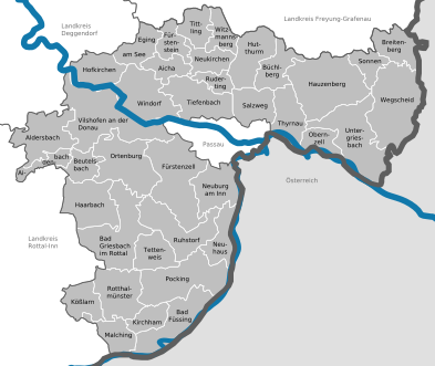
Kommunen
-
Kartierung
hierarchy of administrative territorial entities:
Städte / cities
Bad Griesbach im Rottal
Main gallery: Bad Griesbach im Rottal.
Main category: Bad Griesbach im Rottal
-
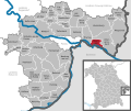
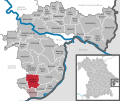
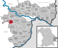
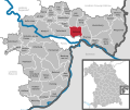
Lage im Landkreis
-
Landschaft bei Bad Griesbach, im Hintergrund Weng
-
Rathaus
-
Stadtplatz
-
desgl.
-
Stadtpfarrkirche Hl. Familie und die Friedhofskirche St. Michael
-
Kurplatz mit Brunnen
Hauzenberg
Main category: Hauzenberg
-
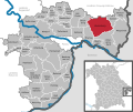
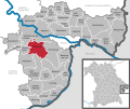
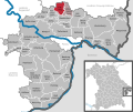
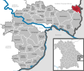
Lage im Landkreis
-
Stadtansicht von Osten
-
Rathaus
-
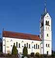
Stadtpfarrkirche St. Vitus
-
Graphit-Besucherbergwerk Kropfmühl (2016)
-
Hauzenberg in der Bildmitte vom Geiersberg aus gesehen, im Vordergrund Raßreuth, links der Staffelberg
Pocking
Main gallery: Pocking.
Main category: Pocking
-
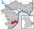
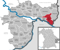
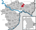
Lage im Landkreis
-
Rathaus
-
Pfarrkirche St. Ulrich
-
Bahnhof
Vilshofen an der Donau
Main gallery: Vilshofen an der Donau.
Main category: Vilshofen an der Donau
-
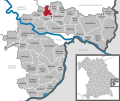
Lage im Landkreis
-
Stadtturm
-
Vilsbrücke mit der Stadtpfarrkirche
-
Historisches Ortsblatt aus dem Jahr 1826
-
Mauer-Denkmal im Bürgerpark Bleiche
-
Pfarrkirche St. Johannes der Täufer
-
evangelische Erlöserkirche
-
Wallfahrtskirche Maria-Hilf
-
Afrikamuseum
-
Schiffsanleger mit Flusskreuzfahrtschiff
Märkte / market towns
Aidenbach
Main category: Aidenbach
-
Lage im Landkreis
-
Rathaus
-
Der Bürgermeister von Aidenbach Karl Obermeier auf einem Traktor während eines Oldtimerumzugs Anno 2011
-
Marktplatz
-
Bauernkämpfer-Statue
-
Bahnhof
Eging am See
Main category: Eging am See
-
Lage im Landkreis
-
Ortsansicht
-
Pfingstmarkt am Marktplatz
-
Rathaus
-
Pfarrkirche St. Ägidius
-
Sonnentherme
-
Kurpark
-
Pullman City
Fürstenzell
Main category: Fürstenzell
-
Lage im Landkreis
-
Rathaus
-
ehemalige Zisterzienserabtei
-
Klosterkirche
-
Pfarrkirche Mariä Himmelfahrt in Höhenstadt
Hofkirchen
Main category: Hofkirchen (Donau)
-
Lage im Landkreis
-
Kriegsgräberstätte
Hutthurm
Main category: Hutthurm
-
Lage im Landkreis
-
Marktplatz
-
Kirche
Kößlarn
Main category: Kößlarn
-
Lage im Landkreis
-
Marktplatz
-
Kirchturm und unteres Torhaus der Wehrmauer der Kirchenburg
-
Silbermadonna im Votivraum der Kößlarner Kirche
Obernzell
Main category: Obernzell
-
Lage im Landkreis
-
Rathaus
-
Epitaph Lukas Kern, Schiffermeister
-
Marktplatz von Obernzell
-
Schloss Obernzell
-
Fischer Kalkstein-Relief von Otto Zirnbauer am Pumpwerk Obernzell, 1956
-
Blick auf Obernzell von der gegenüberliegenden Donauseite
Ortenburg
Main category: Ortenburg
-
Lage im Landkreis
-
Die katholische Pfarrkirche Maria Himmelfahrt, erbaut 1892 bis 1894
-
evangelische Marktkirche
-
Vorderhainberg
-
Der Markt Ortenburg um das Jahr 1620 nach einem Aquarell des Malergrafen Friedrich Casimir
-
Gezeichnete „Luftaufnahme“ Ortenburgs von Graf Friedrich Casimir um 1625
Rotthalmünster
Main category: Rotthalmünster
-
Lage im Landkreis
-
Marktplatz
-
desgl.
-
Rathaus
-
katholische Pfarrkirche Maria Himmelfahrt
-
ehemals Gasthaus, jetzt Apotheke, zweigeschossiger und giebelständiger Satteldachbau mit Vorschussmauer und Putzgliederung, Rundbogenstil
-
Portalstückl
-
ehemalige Volksschule
Ruhstorf an der Rott
Main category: Ruhstorf an der Rott
-
Lage im Landkreis
-
Pfarrkirche Christus der König
-
Marienkirche
-
Rathaus
-
Nikolauskirche
-
desgl.
-
Die Rott bei Frimhöring
Tittling
Main category: Tittling
-
Lage im Landkreis
-
Pfarrkirche St. Vitus
-
Museumsdorf Bayerischer Wald
Untergriesbach
Main category: Untergriesbach
-
Lage im Landkreis
-
Marktplatz
-
Pfarrkirche St. Michael
-
ehem. Kohlbachmühle
-
Grenze zu Österreich (Donauradweg)
Wegscheid
Main category: Wegscheid
-
Lage im Landkreis
-
Rathaus
-
Friedhofskirche St. Anna
-
Pfarrkirche St. Johannes der Täufer
Windorf
Main category: Windorf
-
Lage im Landkreis
-
Rathaus
-
Pfarrkirche St. Jakobus d. Ä.
