Images related to Satellite Data Suggest U.S. Methane Emissions Underestimated

Emissions from Fossil Fuels Continue to Rise
Image

Emissions from Fossil Fuels Continue to Rise

Scientists’ annual checkup on Earth’s carbon cycle found that burning oil, coal, and natural gas is impeding progress to limit climate change.

Published Mar 5, 2024

Image of the Day Atmosphere Land Human Presence

Why Methane Surged in 2020
Image

Why Methane Surged in 2020

Warm, wet weather in the Northern Hemisphere combined with COVID-19 lockdowns pushed the potent greenhouse gas to record levels.

Published Feb 14, 2023

Image of the Day Atmosphere Human Presence Remote Sensing

Mapping Methane Emissions from Fossil Fuel Exploitation
Image

Mapping Methane Emissions from Fossil Fuel Exploitation

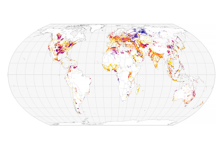
Scientists track the sources of 97 million metric tons of methane emissions.

Published Jan 25, 2022

Image of the Day Atmosphere Human Presence Remote Sensing

Mapping Methane Emissions in California
Image

Mapping Methane Emissions in California

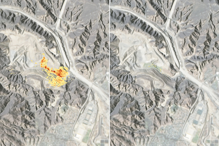
Using precision instruments and new mapping and machine-learning tools, a research team has been pinpointing sources of the greenhouse gas.

Published Sep 9, 2021

Image of the Day Human Presence Remote Sensing

An Outburst from Popocatépetl
Image

An Outburst from Popocatépetl

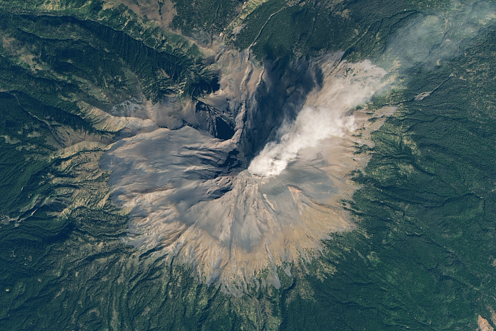
Ash and gas emissions continue from one of Mexico’s most active volcanoes.

Published Jan 6, 2021

Image of the Day Land Volcanoes

Megacities Carbon Project
Image

Megacities Carbon Project

Scientists know cities are major emitters of greenhouse gases, but tracking emissions remains a challenge.

Published Nov 11, 2015

Image of the Day Human Presence

Methane Emissions Continue to Rise
Image

Methane Emissions Continue to Rise

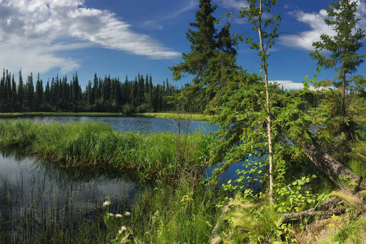
Rapid growth from 2008–2017 built upon the rise in the atmospheric concentration of the gas that has been happening for more than a century.

Published Jul 15, 2020

Image of the Day Atmosphere Remote Sensing

Satellite Catalogs Volcanic Sulfur Emissions
Image

Satellite Catalogs Volcanic Sulfur Emissions

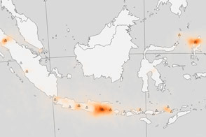
Eruptions are dramatic, but continuous, low-level emissions of volcanic gas are an important input to the atmosphere.

Published Mar 10, 2017

Image of the Day Atmosphere Remote Sensing

The Rise and Fall of SO<sub>2</sub> Over Aruba
Image

The Rise and Fall of SO2 Over Aruba

Emissions maps tell the story of global oil markets.

Published Mar 22, 2017

Image of the Day Atmosphere Human Presence Remote Sensing

Pollutant Emissions Leveling Off a Bit in the U.S.
Image

Pollutant Emissions Leveling Off a Bit in the U.S.

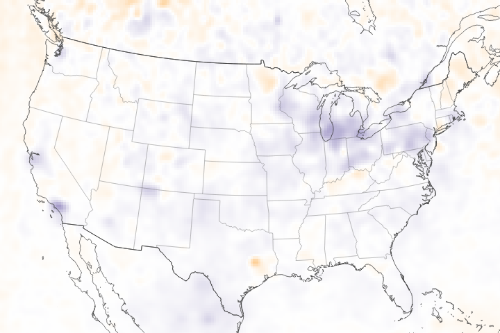
Satellite data show that nitrogen oxide and carbon monoxide are not declining as much as projected by models.

Published May 31, 2018

Image of the Day Atmosphere Remote Sensing

Taking Stock of 2014 Fire Emissions
Image

Taking Stock of 2014 Fire Emissions

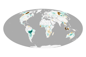
In a year when global fire emissions were average, Canada and Indonesia endured unusually active fire seasons, while South America and equatorial Africa saw less burning than usual.

Published Aug 11, 2015

Image of the Day Human Presence Remote Sensing

Taking Stock of Carbon Dioxide Emissions
Image

Taking Stock of Carbon Dioxide Emissions

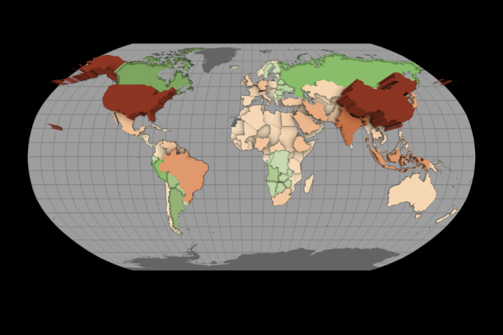
A pilot project has used satellite measurements to estimate emissions and removals of carbon dioxide in individual nations.

Published Mar 8, 2023

Image of the Day Atmosphere