by Alan Buis / GREAT BARRIER REEF, AUSTRALIA /
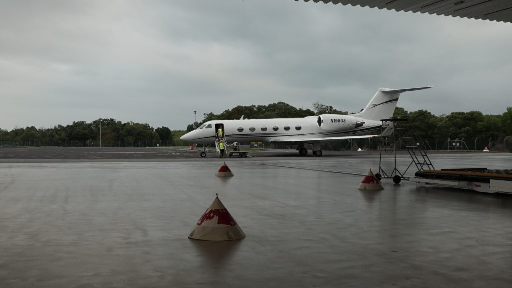
My heart races as I sit snugly buckled in the leather seat of our modified Tempus Applied Solutions Gulfstream IV aircraft on the runway at Australia’s Cairns Airport. For NASA’s COral Reef Airborne Laboratory (CORAL) team, the anticipation is palpable – after days of weather delays, would this be the day we get airborne again? Soon I hear the engines roar to life, and we bolt down the runway, faster than any plane I’ve ever flown in before. We go airborne and climb sharply through mostly cloudy skies, then bank left and head south over the Coral Sea. It’s 8:54 a.m. Australian Eastern Standard Time on Sept. 15.
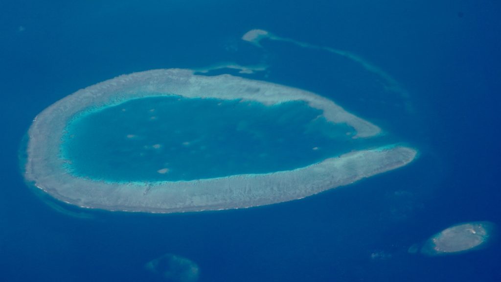
Within minutes the Great Barrier Reef comes into view, in all its stunningly beautiful majesty. A shimmering, luminescent spectacle in shades of aquamarine, turquoise, cyan, white and more, the sight of the massive reef is enough to move one to tears. First a long crescent appeared, fringed by whitecaps, then a wispy auradescent amoeba. As we head farther from the coast, more reef structures appear in an array of sizes and shapes, their sight obscured at times by pockets of clouds. Above us, the sky shines blue and bright; below, clouds dot the seascape. We’re on our way.
It’s hard to imagine that less than three hours ago, as the team assembled for a 6 a.m. weather briefing, the odds of flying seemed uncertain at best due to clouds looming off the coast. Clouds are the enemy of CORAL’s Portable Remote Imaging Spectrometer (PRISM), developed by NASA’s Jet Propulsion Laboratory in Pasadena, California. CORAL will investigate the condition of the Great Barrier Reef and representative reef systems worldwide from its airborne perch 28,000 feet (8,500 meters) above sea level. For the past several days, clouds had grounded the CORAL team.

Hovering above a laptop computer in an office at the plane’s hangar, CORAL project system engineer and mission campaign manager Ernesto Diaz and NASA CORAL project scientist Michelle Gierach, both of JPL, reviewed an animated sequence of satellite cloud imagery. Other members of the team watched or listened in by phone. To the south, the images revealed pockets of clearing over some of CORAL’s target areas. But would the clearing hold for the several-hour duration of a flight?
On the phone Stuart Phinn, professor of geography at the University of Queensland, recommended flying, as the forecast for the next few days was only going to get worse. After further discussion, Diaz recommended the team reconvene at 8 a.m. to make a final go/no-go decision and instructed pilots Josh Meyer and Curt Olds to tow the plane to the tarmac. He also asked the PRISM team to begin preparing for flight. The five-member JPL team aboard the flight – Diaz, optical engineer Holly Bender, lead technician Scott Nolte, JPL videographer Jim Round and I – boarded the aircraft.

As the clock ticked, conditions remained marginal. Finally, it was 8 a.m., and the team convened again by phone. The clear patches to the south had remained. After a few more minutes of discussion, Diaz said, “We are a go.” The target area for today was a region of the Great Barrier Reef near Mackay.
Returning to present time, we head south along the Queensland coastline. It will take about an hour to reach Mackay, located on the south central portion of the reef. The team has targeted up to 20 flight lines to survey with PRISM today out of the CORAL campaign’s planned 151 flight lines over the reef. Our total flight time is expected to be up to five hours (two hours if the weather doesn’t hold when en route).
Diaz and Bender spend the early part of the flight ensuring that PRISM’s flight tracker is set up and jotting down flight lines, while Nolte monitor’s PRISM’s performance. The crew all wear headsets to facilitate communication between themselves and the pilots. PRISM’s focal plane temperature slowly begins to stabilize and eventually reaches its nominal 0 degrees Celsius (32 degrees Fahrenheit). Nolte also monitors the temperature inside the PRISM telescope and the pressure between the vacuum vessel. Thus far, everything looks normal.

We continue heading south, paralleling the Queensland coast, toward our destination about 375 miles (604 kilometers) south of Cairns, a bit more than the distance between Los Angeles and San Francisco.
I ask Diaz and Bender what’s going through their minds at this point in the flight.
“I’m hoping we have no clouds,” says Diaz. “I’m anxious to see how our forecast go/no go decision pans out.”
“I’m really excited,” says Bender, a 10-year JPL employee whose previous NASA airborne flights were in an unpressurized Twin Otter plane. “This is the fourth JPL imaging spectrometer I’ve flown with, but my first day operating PRISM for CORAL. Back at JPL, I work on the optical design and alignment for many of our imaging spectrometers, but to follow an instrument start to finish—from concept to seeing it out in the field—is an incredible feeling. I’m excited to see the data we’re going to get.”
This is essentially a training flight for Bender—the job of collecting PRISM CORAL data is normally a two-person job. The CORAL team members work in two-week stints.
Heading farther down the coast, the city of Townsville appears below along an irregular coastline. To the west, Australia’s vast interior is largely hidden beneath cloud cover. To the left, a large, mostly cloud-free area opens up, with scattered islands piercing the sea surface.
As the team reaches the first target region, they find a mix of cloud cover but it is within acceptable limits. They decide to begin collecting data along their first flight line. A beeping sound from the flight planning tool that sounds something like a percolating coffee pot begins signaling that PRISM is collecting data, in a ground swath measuring 3 miles (4.75 kilometers). They complete the data collection, then maneuver the plane to its next target line, then a third. As they assess the three lines collected, portions of the lines appear cloud-free, while others have 100 percent cloud cover. The team makes a real-time decision about whether to proceed to the next nearest flight line or skip it in favor of one with less cloud cover.

The aerial survey “mows the lawn,” so to speak, as the plane flies back and forth across target regions that have about a 15 percent overlap. Adjacent target flight lines may be in a completely different direction—CORAL scientists target representative reefs across a transsect of the reef from the coastline to the outer reef.
In the meantime, Nolte continues to monitor PRISM. His computer screen shows various data, including the plane’s pitch and roll and its heading, along with a visual of what PRISM sees and a more human-friendly view of the ocean below.
As they continue collecting data, the decision to change the flight plan pans out as flight lines appear to be mostly cloud-free. The team decides to not collect data over some of the flight lines, either due to unfavorable cloud conditions or the sun’s angle above, which becomes increasingly unfavorable as the morning flight continues. “We have about three hours in the morning and three in the afternoon where there are ideal lighting conditions,” Bender says.
After the team completes its 13th line, they decide to return to base. A future flight may collect the other lines. CORAL’s level one science requirement is to image at least half of the mission’s targeted sites. The plane touches down back in Cairns at 1:16 p.m., a little more than 4 hours after takeoff.
“We started off with clouds in the first few lines, but we ended up getting some good weather,” Diaz says. “We collected a good cross section of data from the inner reef to the outer reef. Our decision to fly today was a good one, and PRISM performed like a champ.”
Following the flight, the team shut down the PRISM instrument, removed the nearly 500 gigabytes of data collected and transferred the data to a field server where data processing begins. Initial quick-look data providing a snapshot of what was mapped are typically available within a day—these can sometimes be used to plan the next day’s flight activities. Level one data products take an additional day. More advanced data products are processed off-site.
With the completion of the successful flight, the CORAL team has now collected about a fifth of the data planned for the Great Barrier Reef deployment. The team will remain in Australia through the end of October.
