An Arctic Treasure Hunt

A fuzzy veil of musk ox fur drapes over a pink wildflower plant on the ground.
Musk ox wool, called qiviut, is caught on wildflowers near Thule Air Base, Greenland.
(Credit: NASA/Ramsayer)

by Kate Ramsayer / PITUFFIK, GREENLAND/

It was a duck that led me to treasure. And a plane that led me to the duck.

I set out that afternoon from Thule Air Base, walking down a gravel road with the Greenland Ice Sheet looming in the distance. I was trying to find an interesting view to film NASA’s Gulfstream V as it came back from a flight measuring sea ice for our ICESat-2 field campaign. I failed miserably, the plane landing as a spot in the distance far away.
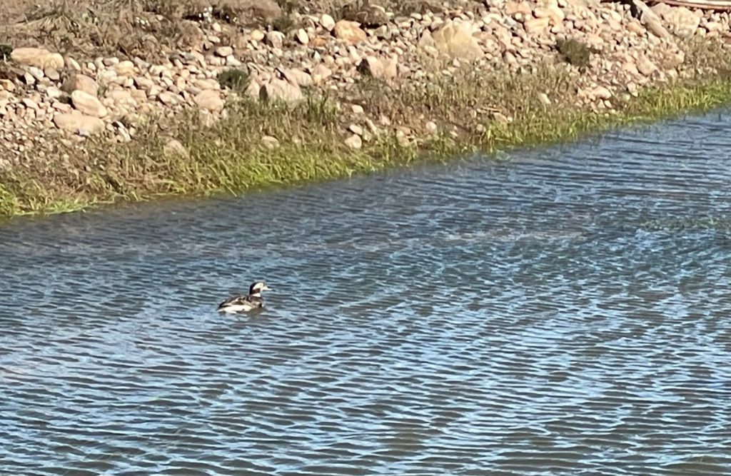
A fuzzy picture of the long-tailed duck in water.
A fuzzy picture of the long-tailed duck that led the author to fuzzy treasure. (Credit: NASA/Kate Ramsayer)

Annoyed, I turned around and glanced at a pond of water by the road and spotted a duck – a fancy duck! I’m not a great birder, but I had studied up on the area birds and recognized it as a long-tailed duck. I crept closer to try to take a picture with my cell phone. It paddled away. I crept. It paddled. And then….

Treasure.

On the far side of the pond, a dull brown piece of fuzz blew in the wind, held by a clump of grass.

I gasped, forgot the duck, and ran over.

It was a dream come true for this knitter – qiviut, the undercoat of a musk ox, softer than cashmere, warmer than wool. I picked it up and rubbed it between my fingers – OK, I picked out a little dirt from it first, then rubbed it through my fingers – and had to laugh at how such a delicate and delicious fiber came from such a hulking beast.

A large shaggy musk ox with stringy brown wool grazes on short grass.
A musk ox – look at that wool it is shedding! – forages near Thule Air Base, Greenland. (Credit: NASA/Kate Ramsayer)

Musk ox are found across the Arctic, and we had spotted several the weekend before on a drive out to the ice sheet. (What do sea ice scientists do on a day off of work? Visit an ice sheet, of course!) The first musk ox we saw was just over a mile from Thule Air Base, and I was surprised to see it so close to noisy humans, grazing peacefully in the hilly tundra of northwestern Greenland.

Although there isn’t a huge diversity of mammals in the region, they’ve been easy to spot on this campaign. That first trip beyond the base, we saw three musk oxen and several huge Arctic hares. I’ve started to recognize the Arctic foxes that live under the building I’m staying in, including a skittish brown kit and shaggy adults shedding their white winter fur.

Top image shows a brown Arctic fox. Lower image shows a white Arctic hare nibling on grass.
An Arctic fox and an Arctic hare
(Credit: NASA/ Kate Ramsayer)

It’s possible the lack of trees makes wildlife-spotting easier. Lack of trees doesn’t mean a lack of flora, however. I was thrilled to realize that our summer campaign overlapped with wildflower season. Yellow poppy-like flowers, white puffballs of Arctic cottongrass, purple petals sticking up from a bed of moss, all thriving in the harsh environment. Walking to the ice sheet, one of the scientists and I fell behind while taking pictures of these hardy plants, growing in the rocky glacial moraine.
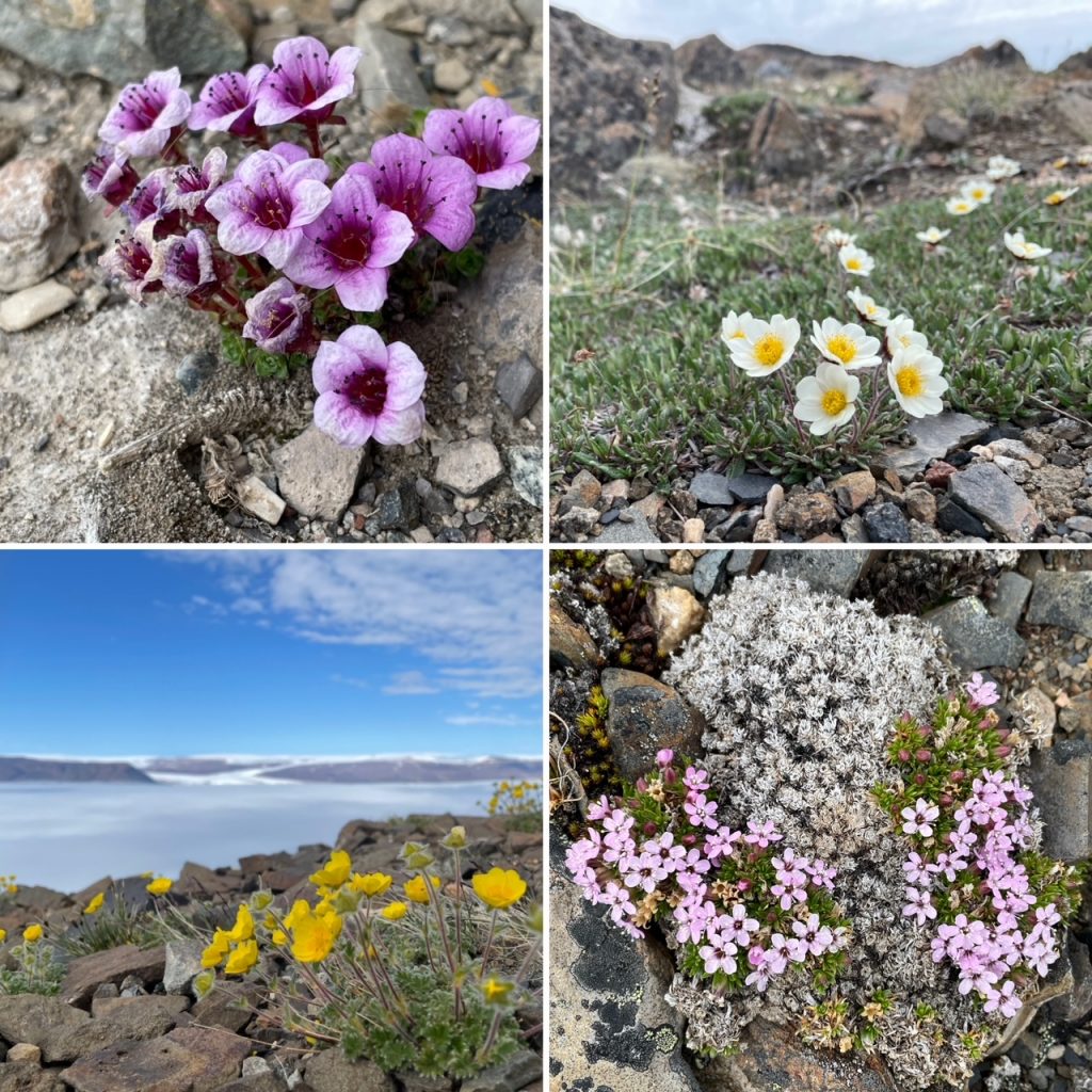
Four images of pink and yellow wildflowers grouwing out of crevices in the rocks.
Wildflowers bloom in the rocky soil of northwest Greenland.
(Credit: NASA/Kate Ramsayer)

Back to the qiviut. I found that first bit, then looked around and saw more. Other clumps were hooked on a piece of wood, or a little flower. Musk ox hoofprints and poop provided further evidence of what had wandered by. I followed the prints and poop, picking up clumps of qiviut, like a kid on an Easter egg hunt. If you ever need to lure me into a haunted cottage in the woods, just leave a trail of heavenly fiber – I will skip merrily into the trap.

A clump of musk ox wool piled up on a table.
Qiviut, the soft undercoat fiber from musk ox, the stuff of a knitter’s dream.
(Credit: NASA/Kate Ramsayer)

Walking back to Thule with a pocket stuffed with musk ox wool, admiring flowers poking up from the side of the road, watching a snow bunting flit across another pond, I know how fortunate I am to explore this unique environment. It’s like nothing I’ve seen before, and I doubt I’ll see anything like it again.

The Arctic is warming four times faster than any other region of the planet. I wonder how these hardy animals and plants, so well suited to their frozen ecosystem, will fare. A recent study described a population of polar bears in southwestern Greenland that now rely on glacial ice, instead of the sea ice that is typical seal-hunting grounds for other polar bears, as the sea ice in their habitat has disappeared for most of the year due to climate change.

As a writer who works with NASA scientists investigating how a warming climate impacts our planet, I’m continuously amazed at how well we can measure change even in these remote places. As a visitor to this incredible spot beyond the Arctic circle, I truly hope these flora and fauna can adapt to this ongoing change.
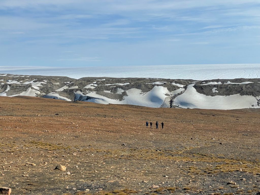
The Greenland landscape. The lower part of the image shows brown rocky ground with four tiny dots of people walking toward the ice sheet in the midground. The horizon is above the ice show blue sky lightly overcast with a sheet of white bumpy clouds.
Scientists with the ICESat-2 field campaign walk across the tundra toward the Greenland Ice Sheet. (Credit: NASA/Kate Ramsayer)

Rocking and Rolling Over Summer Sea Ice

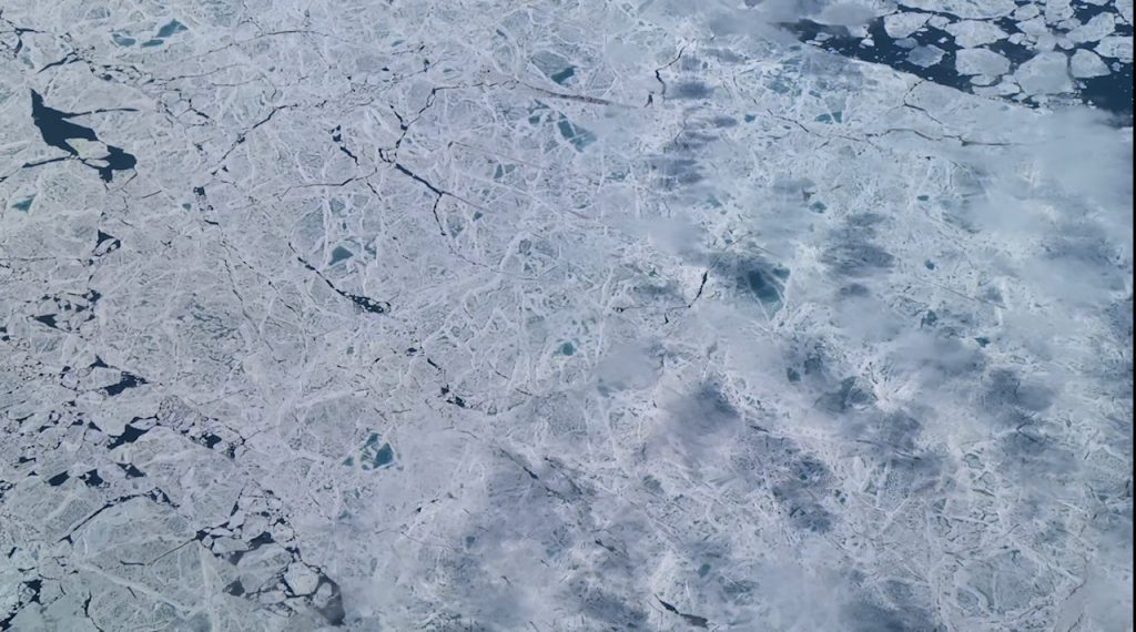
An airplane view of sea ice in mottled white and blue with cracks.
The thickness of melting Arctic sea ice, seen here north of Greenland on July 11, 2022, is tricky to measure from space, but a NASA campaign is designed to improve height measurements from the ICESat-2 satellite. (Credit: NASA/Kate Ramsayer)

By Kate Ramsayer / PITUFFIK, GREENLAND/

I can’t quite find the right words to describe summer sea ice from the air – which is unfortunate, since I’m writing this post about NASA’s ICESat-2 summer sea ice airborne campaign.

It’s like miles and miles of shattered glass, these bits and pieces of ice broken apart and jammed back together. It’s like a honeycomb pattern, except, well, more a mishmash of geometric shapes, no neat hexagons. A 10,000-piece jigsaw puzzle of white ice floes and teal melt ponds and dark open ocean? Let’s go with that.

We’re flying above the Arctic Ocean in NASA’s Gulfstream V plane, a repurposed corporate executive jet (the swoosh branding of the previous owner still adorns the stairway). Onboard are two laser instruments that precisely measure the height of the ice, snow, melt ponds and open ocean below. Hundreds of miles above us, earlier that morning, the ICESat-2 satellite flew the exact same path, measuring the same ice. Scientists will compare the sets of data to improve how we use the satellite measurements, and better understand how and when sea ice is melting in the warming summer months.

The view of sea ice out the airplane window. White extends in all directions to the horizon line, cloudless blue sky above.
Arctic sea ice and clouds, as seen from NASA’s Gulfstream V jet on July 11, 2022. (Credit: NASA/Kate Ramsayer)
Two women and two men are gathered around a pair of laptoms, looking at the screens in carpeted hotel room.
NASA Goddard scientists, from left, Nathan Kurtz, Michelle Hofton, Marco Bagnardi and Rachel Tilling study weather forecast models and ICESat-2 flight paths to plan a flight over the Arctic Ocean. (Credit: NASA/Kate Ramsayer)

Lining up the instrument measurements and the satellite measurements is no easy feat. Starting days before, the scientists had gathered in a common room at our hotel on Thule Air Base in northwestern Greenland, comparing the orbit paths of ICESat-2 with weather forecasts of clouds. Clouds are the scourge of summer airborne campaigns in the Arctic – large storm systems can cover almost the entire ocean, and weather forecast models are not as reliable at this high latitude.

But on this first flight of the campaign the clouds clear for long stretches, sending the scientists, instrument operators and yours truly to the windows to oooh and ahhh at the spectacular ice below.

“Now this is the good stuff,” said Rachel Tilling, sea ice scientist at NASA’s Goddard Space Flight Center, as the abstract stained glass mosaic (that any better?) of sea ice appears under sunny skies.

It’s mesmerizing, watching all the ice go past, seeing the cracks between flows and the ridges where the bits of ice have slammed into each other and refrozen. This campaign is particularly interested in measuring melt ponds, bright bits of teal where the snow covering the sea ice has melted and pooled, causing the ice to thin from the surface.

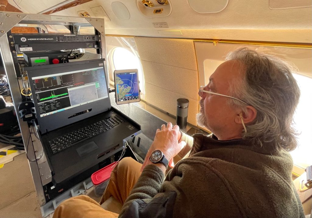
On the aircraft a scientists sits in gront of a boxy instrument, looking at the screen readout.
NASA Goddard’s David Rabine monitors the LVIS instrument as it gathers height data on the melting Arctic sea ice below. (Credit: NASA/Kate Ramsayer)
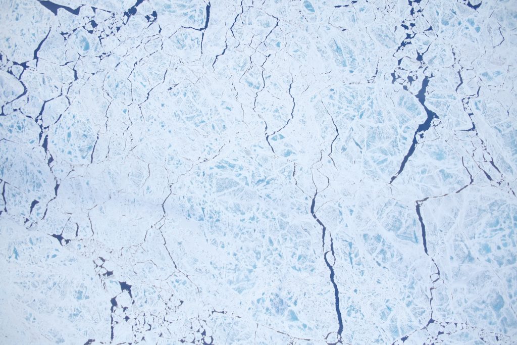
The view of sea ice from directly above taken by the LVIS instrument. Mottled white and pale blue sea ice with thin cracks fills the scene.
NASA’s Land, Vegetation and Ice Sensor (LVIS) uses a laser to measure the height of what it flies over, and also carries a camera to collect images like this one, over the Arctic Ocean north of Greenland on July 11, 2022. (Credit: NASA/LVIS team)

As we kneel in front of the port windows, looking out, the laser instruments are right next to us, looking down. On this flight, Goddard’s Land, Vegetation and Ice Sensor (LVIS, pronounced like The King) is firing its laser to time how long it takes for light to go from the plane to the ice or pond or water and then return; ICESat-2 is doing much the same thing from orbit.

It’s not all smooth sailing, though. To calibrate LVIS, the plane has to do a series of pitches and rolls. In the air. Over the polar ocean. With me on board.

I’m not a huge fan of flying. It’s only been a decade or so that I can fly without imagining a fiery death every time we hit a bit of turbulence. (I know, “physics,” but still.) I tolerate it, though, because I love going places.

A view from the plane of Grenland's white glaciers on land in the top and top right of the image. Brown rock of the cliffs and shoreline are a buffer between the land ice and the gray-blue sea ice on the ocean. Broken chunks of icebergs are on the right edge of the image, and a brown rocking island is in the bay.
Glaciers flow into a frozen fjord dotted with icebergs in northern Greenland, as seen from NASA’s Gulfstream V jet flew from Thule Air Base to measure sea ice for the ICESat-2 airborne campaign. (Credit: NASA/Kate Ramsayer)

But now we’re in a small plane, intentionally doing a series of pitches (up fast, then down fast) and rolls (one wing down, then the other wing). Intentionally. Three times. The first time is the worst, says Nathan Kurtz, ICESat-2 deputy project scientist and the campaign’s leader. Maybe for some; not for me. The first time was kind of fun, I’ll grant you, and there’s video evidence somewhere of me laughing nervously.

The second time: “Isn’t the LVIS calibrated well enough?” was the primary thought in my mind, which is why I’m not an instrument scientist.

The third time, I was regretting the snacks I had brought along for the flight. Look to the horizon, I told myself – right as the plane started its rolls. The horizon quickly disappeared, and then the plane rolled the other way, and it was all ice, and then it rolled the other way….

I closed my eyes, took deep breaths, and imagined the spectacular view, a patchwork of ice and water, that would be there once the plane stopped rolling.