The Magic of the Marianas and Micronesia

Eric Hochberg gives the “OK” sign after completing a set of benthic reflectance measurements in Palau. Credit: Stacy Peltier

by Ali Hochberg / WESTERN PACIFIC OCEAN /

Many people are familiar with—or have at least heard of—the Mariana Trench. Located in the western Pacific Ocean, this crescent-shaped feature on Earth’s crust is the deepest part of the world’s ocean, reaching a maximum depth of 10,994 meters (36,070 feet) in an area known as “Challenger Deep.”

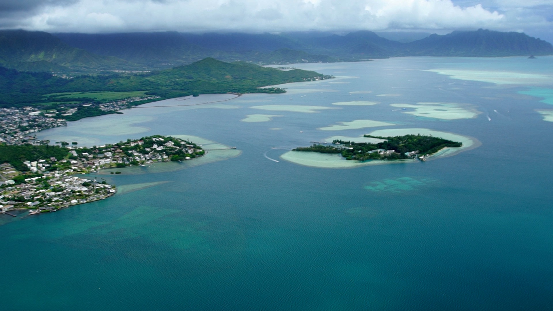
Fewer people, however, are familiar with the Mariana Islands—a chain of 15 islands that include ten uninhabited volcanic islands to the north and five limestone islands to the south. The Marianas are divided into two political regions: the Commonwealth of the Northern Mariana Islands (a Commonwealth of the United States comprising Saipan, Tinian, and Rota) and Guam (a US territory). Fringing the coasts of each of these islands are lush coral reefs that support indigenous fishing and a large tourism economy, including many ecotourism opportunities.

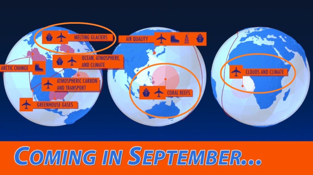
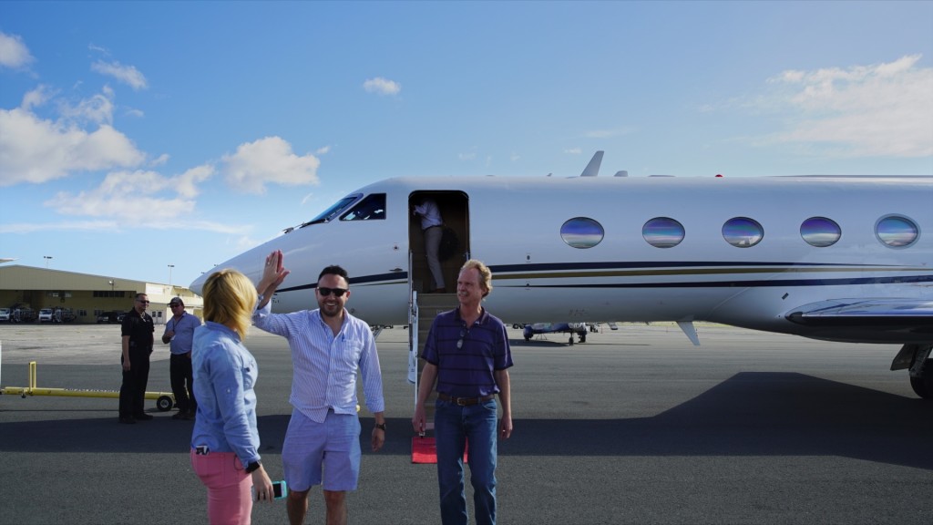
For six weeks in April and May, the coral reefs of the Mariana Islands also supported a cadre of scientists deploying instruments and collecting data as part of NASA’s COral Reef Airborne Laboratory (CORAL) mission. Using a state-of-the-art sensor—the Portable Remote Imaging Spectrometer (or PRISM)—housed in a Gulfstream-IV airplane, CORAL will provide a new perspective on the function and future of coral reef ecosystems.

The CORAL team in Palau (from left): Brandon Russell (UConn), Chiara Pisapia (CSUN), Lori Colin (CRRF), Pat Colin (CRRF), Stacy Peltier (BIOS), Bob Carpenter (CSUN), Eric Hochberg (BIOS), Andrea Millan, Alex Hunter (BIOS), Yvonne Sawall (BIOS), Steve Dollar (UH), Rodrigo Garcia (UMass), Sam Ginther (CSUN)

The data collected by PRISM, and validated through extensive in-situ (or in-water) measurements in the field, will form a series of maps that indicate the relative densities of coral, sand, and algae in each study area, as well as rates of primary productivity (the creation of new organic material) and calcification (the process by which reefs produce calcium carbonate, an important determinant of reef health). With these maps, the CORAL team can build models to help scientists, resource managers, and politicians better predict how reefs are impacted by both natural and human processes.

From April 7-18, the CORAL field validation teams surveyed locations in Guam and from May 1-16 they conducted similar validation activities in Palau, an island nation southwest of Guam and the Northern Mariana Islands whose coral reefs have been named one of the “Seven Underwater Wonders of the World” by the Council for Educational Development and Research. (The Great Barrier Reef and the Galapagos Islands are two other famous examples on this list.)

While in Guam, the three in-water validation teams surveyed 65 benthic cover sites (from which high-resolution photo-mosaics will be produced, allowing for detailed analysis of the various types of seafloor, or benthic, habitats), 6 metabolism gradient flux sites (which reveal information about reef productivity), 1 metabolism Lagrangian site (with instruments that measure reef productivity and calcification in a set mass of water, over a specific amount of time, along a set transect across the reef), and 42 water optical property sites (which yield information on how light travels through the water column, from the surface to the seafloor and back).

Having spent a significant amount of time doing underwater surveys in Guam during the mid-2000s, Eric Hochberg, an associate scientist at the Bermuda Institute of Ocean Sciences and the CORAL principal investigator, was pleased to see the reefs looking much the same as they did a decade ago.

“The conditions in Guam were great, with the water ridiculously clear just a few hundred meters offshore,” said Hochberg. “Honestly, the biggest challenge in Guam was the fact that we didn’t have access to a working field lab and had to create a makeshift lab in a conference room at the Hilton!”

Brandon Russell, a postdoctoral fellow at the University of Connecticut and part of the CORAL optics team, echoed Hochberg’s sentiments about the challenges in Guam. “Working in remote locations is incredibly challenging,” Russell said. “It forces you to be flexible in planning and implementation to successfully collect good data but, if you can overcome these challenges, there’s a great opportunity to collect a huge, unique, and varied data set.”

In Palau, the field teams surveyed 74 benthic cover sites, 10 metabolism gradient flux sites, 2 metabolism Lagrangian sites, and 52 water optical property sites. In addition, 23 sites were studied with an underwater spectrometer to collect measurements of benthic reflectance, or the amount of light that is reflected from the seafloor back to the ocean surface. Each benthic community—in this case coral, sand, and algae—has a different spectral “signature” (how much light is reflected as a function of wavelength), which means that measurements of benthic reflectance can be used to identify the composition of the seafloor.

A view of Palau’s stunning and diverse coral reefs, along with some of its local fauna. Credit: Eric Hochberg

The reefs in Palau lived up to their billing, providing a stunning natural backdrop for the CORAL survey work being conducted. Stacy Peltier, a research technician in Hochberg’s lab at BIOS and part of the CORAL benthic team, said the reefs there were a completely new experience for her.

“While in Palau we discovered a gap in our underwater communication,” Peltier said. “We had no way of conveying how awesome something was, so we had to invent a new diver signal: the head explosion. The scenery was so overwhelming you could barely decide what to look at.”

And, unlike in Guam, the CORAL team had access to dedicated facilities and research vessels in Palau courtesy of the Coral Reef Research Foundation and the dynamic husband-and-wife team of Pat and Lori Colin, the foundation’s director and laboratory manager/research biologist, respectively.

“It’s not an exaggeration to say that we wouldn’t have been able to complete this portion of the CORAL mission without the support of Pat and Lori,” Hochberg said. Agreeing, Peltier said, “Pat and Lori were eager to share their knowledge of Palau’s reefs and actively guided us through so many field aspects that could have easily turned into serious problems.”

The airplane carrying the PRISM instrument shuttled between bases of operation on Guam, Yap (part of the Federated States of Micronesia), and Palau, allowing the flight team to take advantage of shifting weather windows in each region. Over the six-week campaign a total of 75 flight lines were collected, representing at least partial coverage of reef areas in Guam, Rota, Tinian, Saipan, Farallon de Medinilla, Anatahan, Guguan, Alamagan, Pagan, Asuncion, Maug, Farallon de Pajaros, and Palau.

With the campaign in the western Pacific complete, and with flight hours remaining, the CORAL investigation ended on a high note by flying PRISM over reef tracts in the Florida Keys. This “bonus reef” is the first CORAL data set from the Atlantic Ocean and will serve as another representative reef area in terms of reef type, physical forcings, human threats, and biodiversity.

“As we ended the campaign with a number of planned flight hours ‘in the bank,’ we were able to quickly formulate a plan to image the coral reefs around Florida,” said William Mateer, CORAL project manager with NASA’s Jet Propulsion Laboratory. “This reef was the initial location for the CORAL operational readiness test.  Weather cooperated and we had two days of great collections (22 lines) to add to the data available for science analysis.”

The field and airborne teams have returned to their respective home institutions and the CORAL project is now moving into the data processing and analysis phase, which will extend into 2018. CORAL datasets and data products are publicly available. For more information, please visit www.coral.bios.edu/data, which will be updated as data become available, and www.coral.jpl.nasa.gov.

Working Around the Weather

Steve Dollar (UH) heads to a benthic validation site on Maui. Credit: Stacy Peltier, BIOS
Steve Dollar (UH) heads to a benthic validation site on Maui. Credit: BIOS/Stacy Peltier

by Ali Hochberg / HONOLULU, HAWAII /

Understanding our planet and how it functions, as well as the impacts that human activities have on it, requires frequent and extended forays into the field to yield valuable data and observations. The COral Reef Airborne Laboratory (CORAL) investigation is a prime example. The three-year mission, funded by the NASA Earth Venture Suborbital-2 program, is conducting airborne remote sensing campaigns, along with in-water field validation activities, across four coral reef regions in the western and central Pacific Ocean.

“The objective is to conduct coral reef science at the ecosystem scale to find out the relationship between reef condition and the biogeophysical factors we think impact reefs,” said Eric Hochberg, CORAL principal investigator from the Bermuda Institute of Ocean Sciences, St. George’s, Bermuda. “With that understanding, we can build models to help scientists, resource managers and politicians gain a new perspective on reef function and better predict how natural and human processes will shape the future of reefs.”

When CORAL traveled to Hawai‘i last month for its second field campaign, it already had nearly a year of the mission under its belt. The Operational Readiness Test (ORT) took place in Hawai‘i last summer and the team completed a successful first field campaign in Australia’s Great Barrier Reef last fall. During both, communications between the airborne and field teams were streamlined, field operations and equipment deployments were tested and refined, and team members gained valuable experience working with both equipment and each other.

Eric Hochberg (BIOS), Bob Carpenter (CSUN) and Yvonne Sawall (BIOS) hold a team meeting before heading out to the field. Credit: NASA/James Round

Even with years of planning and preparation, however, such ventures are always undertaken with the knowledge that some variables are out of the researchers’ control. For the CORAL team, there was one thing they couldn’t prepare for in Hawai‘i: the weather.

While the in-water field teams can—and do—work in what are often considered adverse conditions, the weather can still take a toll on the instruments left in the water to collect data.

“Our metabolism work on the fore reef of Kāneʻohe Bay was going well until a large north swell wrapped around to the windward side and toppled one of our gradient flux instrument stands,” said Robert Carpenter, CORAL co-investigator from California State University Northridge and leader of the reef metabolism team. “Luckily, it happened during the night before we were going to pick the instruments up, so we did not lose any data and the instruments were not damaged. Because of the swell, we continued the remainder of our data collection in the back reef and lagoon. So much for a calm time of the year!”

Brandon Russell (UCONN) checks instrumentation before a field deployment. Credit: BIOS/Stacy Peltier

Unlike the in-water teams, the airborne operations for CORAL require substantially fairer conditions. The PRISM (Portable Remote Imaging Spectrometer) instrument that forms the backbone of the CORAL science is housed in the belly of a Gulfstream-IV airplane that flies over survey areas at an altitude of 28,000 feet. In order to obtain the most accurate spectral data possible from the seafloor, the airplane must fly in relatively cloudless skies with low surface winds over clear waters.

“One of the biggest operational challenges that the CORAL Hawai‘i campaign faces is the weather,” said CORAL project engineer Ernesto Diaz from NASA’s Jet Propulsion Laboratory, Pasadena, California. “For optimal data, a clear line of sight between the sun and the coral reefs is necessary, making clouds CORAL’s biggest enemy. Hawai‘i’s tropical location, the drastic topography differences within each island, and the trade winds, are some of the factors that make forecasting clear weather days particularly tricky. A clear day over an entire island is uncommon so we usually plan for collections over portions of the islands that have the best clear sky forecast, i.e. windward, or leeward sides. All of these factors make a successful data collection flight very rewarding.”

CORAL scientists also had to contend with a significant rain event over the region in late February as a slow-moving storm system dumped rain on the islands for two straight days and caused urban flooding in many areas. These floodwaters, originating on land and emptying into the surrounding ocean, led to a significant amount of soil runoff in areas. The additional sediment in the waters reduced water clarity and, as a result, impacted the ability of the PRISM instrument to “see through” the water to the seafloor.

A view from the water of the lush vegetation on Maui. Credit: BIOS/Stacy Peltier

Despite these challenges, the CORAL team was able to complete in-water validation activities in Kāneʻohe Bay and collect flight lines over the Big Island (the island of Hawai‘i), Maui, O‘ahu, Kaua‘i, Ni‘ihau, Moloka‘i, Lana‘i, and Kaho‘olawe. The benthic team also visited Maui and the Big Island to gather data for various benthic communities not represented in Kāneʻohe Bay.

“It was nerve-racking checking the weather forecasts each day and following the progress of the airplane, hoping for clear skies and calm waters over the different islands where we needed PRISM data,” said Hochberg. “We got some good breaks, though, and the Hawai‘i campaign was successful. Next month we get to start it all over again in Guam and Palau. I’m looking forward to it!”

Taking the Pulse of the Reef: “It’s Algalicious”

SCUBA diver
Sam Ginther, California State University, Northridge, goes into the water Credit: NASA-JPL/Alan Buis

by Alan Buis / OFF HERON ISLAND, QUEENSLAND, AUSTRALIA /

Bob Carpenter surveys the seafloor surrounding the research vessel Anthias as it glides over Blue Lagoon, the largest part of the reef that envelops Heron Island. He and his team, which is conducting the in-water validation of reef metabolism for NASA’s Coral Reef Airborne Laboratory (CORAL) mission, are searching for a good spot among the numerous small patch reefs in the lagoon to erect what he calls an “underwater construction project.”

The boat stops to look at an area more closely.

“It’s looking pretty algalicious here,” says Carpenter with a laugh, knowing he just made up a word. He asks skipper Sam Ginther, a research technician at California State University, Northridge, where Carpenter is a professor of biology, to continue to another location.

Carpenter has brought his three-person team to the Great Barrier Reef to make in-water measurements of the productivity and calcification of the community of living organisms found on the seafloor here at Heron Island and also at Lizard Island, on the northern Great Barrier Reef. Their data will help the CORAL team validate CORAL’s advanced Level 4 science products.

It’s mid-September and day two out in the field for the team at Heron. They’ll be here for another week, installing instruments at up to 10 sites around Heron Reef. Yesterday they deployed a float called a drogue to track the paths of currents below the water surface to help guide their placement of instruments. On today’s trip they’ll be deploying two types of instruments: samplers that collect water for later analysis in the lab, and gradient flux instruments that measure oxygen and water flow.

At this location they are deploying the “gradient flux” instruments. The instruments will measure two of the three key aspects of reef metabolism his team is studying: primary productivity and respiration (the third is calcification). Metabolism refers to the processes by which reef communities acquire energy for growth and build their limestone skeletons.

SCUBA Diver
Sam Ginther, California State University, Northridge, takes a gradient flux instrument from Chiara Pisapia, James Cook University. Credit: NASA-JPL/Jim Round

The team must work quickly, because the high and low tides here at this time of the month are extreme.

“I think the difference at this time of day is 7.2 feet, so we need to get out to the lagoon when it’s high tide so we’ll have deep enough water to navigate in when we’re entering the lagoon and going over the reef crest,” says Chiara Pisapia, a postdoctoral researcher from Italy who came to Australia six years ago and recently completed her postdoc at James Cook University. She’s now joining Bob’s group at CSUN. “If we’re still in the lagoon when the tide goes down, we’ll be stuck here until the next high tide.” The team will have a little more than two hours in the lagoon, which averages about 11 feet in depth, to accomplish today’s tasks. The instruments have to be placed where they won’t go dry when the tide goes out.

The gradient flux system—oxygen sensors and acoustic Doppler velocimeters—will be mounted at two heights above the seafloor. The bottom instruments are placed 4 inches above the flora and fauna on the seafloor, with the top instruments placed 43 inches above the seafloor. The method they’re using relies on the flow of water to carry water and oxygen (either produced by photosynthesis or taken up by respiration) past the instruments.

“The water here doesn’t always flow in the same direction, so we’re looking for a coral patch that’s fairly uniform where the water will carry data signals on the surrounding habitat past these sensors,” Carpenter says. “We’ll then place the sensors right in the center of that patch so they will integrate the metabolism from that point to a larger scale: anywhere from 108 square feet to perhaps 538 square feet , depending on the speed of the water flow. Since the pixel size for PRISM’s spectrometer on the Gulfstream IV aircraft is 86 square feet, we’re able to match its scale really well.”

The team locates a suitable spot in the lagoon and gets to work, donning scuba gear and taking the equipment they will need down to the seafloor below. The equipment includes a tall cylindrical stand with adjustable brackets and clamps that hold the four gradient flux instruments in place at fixed heights to eliminate any bias in the measurements.

Bob Carpenter and Sam ginther, both of California State University, Northridge, set up gradient flux instruments. Credit: Chiara Pisapia.
Bob Carpenter and Sam Ginther, both of California State University, Northridge, set up gradient flux instruments. Credit: Chiara Pisapia.

The sensors will continuously measure oxygen and water flow across the layer of water directly above the organism-covered seafloor, providing measurements of the area’s net productivity during the day and its respiration at night. Upon completing the installation, the divers release a special yellowish-green, reef-safe dye, which allows them to verify that water is flowing across the instruments. A member of the team notes the location of the installation using a portable GPS receiver. The team will repeat the process tomorrow, moving the instruments to a new location on the reef every 24 hours.

Earlier in the day, the team used GPS coordinates to locate instruments they installed in the lagoon yesterday that are used to measure reef metabolism, and placed two CSUN-built integrated water samplers at the same locations. The water samplers were placed about 1,312 feet apart, one downstream from the other, moored to the seafloor. They remain in place for five consecutive days.

“The water samplers take tiny little sips of water—only about 3 or 4 milliliters a minute—and they do that for six hours, so you get this long-term water sample, and we do that at both ends of the transect, and then we can come out tomorrow and collect the samples from the sample bags,” Carpenter says.

The team swaps the sample bags out and takes them back to the lab to analyze for total alkalinity. Changes in total alkalinity can be used to estimate reef calcification, a key element of reef metabolism.

Calcification is the secretion of calcium carbonate—what we think of as limestone. Coral skeletons and other calcifying organisms such as calcified algae build the reef framework, allowing reef systems to grow vertically over time to create the largest biogenic structures on Earth. The process of calcification is fundamental to the growth of corals and reefs in general. As climate changes and sea surface temperature and ocean acidification increase, calcification is predicted to decrease. In fact, experiments are showing that calcification decreases with simulated increases in ocean acidification and temperature.

Carpenter says the team wants to sample as many different habitats as they can so that CORAL’s benthic cover in-water validation team will know exactly what the metabolism is for these different habitat patches. “We install the instruments in a location, leave them for about 24 hours, and mark them with a float,” he says. “Then the benthic cover team comes the next day and creates their photo mosaic of the area. So we end up knowing exactly what’s there and exactly what the rates of metabolism were in those same patches. We can then match those different habitats with PRISM data to hopefully extrapolate what the reef is doing on a larger scale.”

Their work for the day complete, Pisapia takes the helm and carefully navigates the boat through the shallow corals out of the lagoon and back to the harbor. Tomorrow they’ll go out again and move another set of instruments. Their work here on Heron Island will be followed by several months of data processing and analysis.

Humpback whale
A young humpback whale swims in the waters off Heron Island. Credit: Bermuda Institute of Ocean Sciences/Stacy Peltier

As they head for shore, a large humpback whale and her calf breach out of the water a short distance away. They stop for a minute to watch in awe. Life is good.

Coral Reef Close-up: CORAL Goes Down Under Down Under

Coral and fish
Coral and fish at Heron Island Reef. Credit: Stacy Peltier

by Alan Buis / OFF HERON ISLAND, QUEENSLAND, AUSTRALIA /

It’s a warm and sunny morning in mid-September as Stacy Peltier and her colleagues on NASA’s Coral Reef Airborne Laboratory (CORAL) mission survey team prepare for their first day in the water at Heron Island, a 42-acre coral cay about 45 miles off the coast of Queensland, Australia. As she places a Nikon D5500 camera into an underwater housing, several sharks swim nearby in the aquamarine waters of the island’s small harbor dredged out of the reef.

“I’ve never jumped in the water with tons of sharks before,” she quips with nervous laughter.  Fortunately for her and her team, the sharks found around Heron Island aren’t particularly dangerous to humans.

Shark swims in a harbor
A shark swims in Heron Island Harbor. Credit: Jim Round/NASA JPL

The research technician from the Bermuda Institute of Ocean Sciences (BIOS) and her three teammates have come to Heron Island as one of three independent, but coordinated, in-water validation teams that are collecting data on reef condition at Australia’s Heron and Lizard Islands during CORAL’s two-month Great Barrier Reef study. This “ground truth” data will be compared with data collected from the air by NASA’s Portable Remote Imaging Spectrometer (PRISM) instrument to validate the accuracy of the PRISM data and map products. Three fundamental types of data are being gathered: water optics, reef benthic cover and reef metabolism.

Benthic cover is what grows on the seafloor. Reef benthic communities typically consist of a combination of coral, algae and sand. Over the next week, the benthic cover team is collecting a series of high-resolution photomosaics that will depict the composition of the various seafloor communities at multiple spots around the Heron Island reef.

Surveys of reef benthic cover are needed to validate some of CORAL’s more advanced data products. The CORAL mission is collecting benthic cover data for 160 to 250 separate sites across each reef validation location in the global mission. The team will analyze the mosaics to make a highly accurate determination of the percentages of various types of benthic cover in each photo.

By 9 a.m., the boat is loaded with the team’s research equipment and scuba gear.  Peltier, co-skipper on today’s trip, slowly guides the Heron Island Research Station research vessel Chromis out of the harbor. As they head out, the ghostly, rusted wreck of the HMCS, Australia’s first official naval vessel, sits on its side on the reef crest at the entrance to the harbor.

Shipwreck of the HMCS, Australia’s first official naval vessel. Entrance to Heron Island’s harbor. The wreck was placed there many years ago to serve as a breakwater for small craft visiting the island. Credit: Jim Round/NASA JPL
The shipwreck of the HMCS, Australia’s first official naval vessel, lies at the entrance to Heron Island’s harbor. The wreck was placed there many years ago to serve as a breakwater for small craft visiting the island. Credit: Jim Round/NASA JPL

On board with Peltier are teammates Yvonne Sawall, a postdoctoral scientist at BIOS; research technician Andrea Millan and team leader Steven Dollar, both of the University of Hawaii; and NASA CORAL project scientist Michelle Gierach, who’s come along to observe and assist from the boat.

Peltier radios the research station to report that there are seven passengers on board and that we are expected back to harbor at 4 p.m.

“Research, Research, Research, this is Chromis,” she says.

The station confirms, and informs us that the Gulfstream IV aircraft carrying NASA’s PRISM instrument is on its way to fly over the Heron Island region and is expected soon.

Research boat
Steve Dollar, University of Hawaii, pushes the research vessel Chromis at the start of the day. Credit: Jim Round/NASA JPL

Our first dive point is an area called Blue Pools. The team attaches the boat to a mooring buoy. The water depth is about 20 feet.

The team quickly gets to work, donning scuba gear and plopping backward into the 72-degree Fahrenheit water. The skipper does not get in the water; she must remain with the boat at all times for safety purposes. The divers are handed one of the three cameras on board and they submerge.

Scientists at work near a reef
Stacy Peltier, Bermuda Institute of Ocean Sciences (BIOS), hands an underwater camera to Yvonne Sawall, also from BIOS. Credit: Jim Round/NASA JPL

It’s painstaking work. One team member first lays 1.6-foot-long poles across the seafloor to delineate 33-by-33 foot square plots, a size that correlates to the spatial resolution of CORAL’s PRISM instrument from 28,000 feet above sea level.

The other team members use their cameras to photograph the entire plot, with one diver scanning east to west and the other scanning north to south, swimming about 6 feet above the seafloor. A snorkeler at the water’s surface carries a handheld GPS unit to precisely mark the location of the plots to correlate with the plane data.

Scientists photographs the sea floor
Andrea Millan, University of Hawaii, photographs the sea floor. Credit: Stacy Peltier

The team takes up to 1,000 pictures per plot, a process that takes 15-20 minutes. On a typical day the team will do two to three locations, collecting measurements from three to four sites at each location. They start in the deepest water, then move up the slope of the reef toward shore. If the water becomes too shallow they snorkel instead of scuba.

Later, back on land, a special software tool called Agisoft PhotoScan will stitch all the photographs together into a mosaic, which scientists can then use to characterize what the community structure of the coral reef is at the given spot.

“This is a new way of assessing reef structure and function using this mosaic, and we’ll follow it with analysis of these pictures to be able to see things you can’t see any other way but by jumping in the water and putting your eyes on it,” says Dollar, a coral reef biologist and environmental consultant. “This is the equivalent of going from a Model T to a Tesla compared to the way previous reef studies have been done. And the biggest thing that allowed this to happen is digital photography. Here, each time we come out of the water, we’ve taken up to a thousand pictures. This was not possible before the advent of digital photography.”

The CORAL research team aboard the Chromis. Credit: Jim Round/NASA JPL
The CORAL mission survey team aboard the Chromis. Credit: Jim Round/NASA JPL

“We want to get as many different benthic community types as possible, and then match up the mosaics with the pictures we get from the airplane,” says Sawall, a postdoc with CORAL Principal Investigator Eric Hochberg at BIOS, where she specializes in coral metabolism.

A native of the south of Germany, Sawall was first inspired to study coral reefs when she dived the Great Barrier Reef at age 19. “It was my first experience in the ocean; I loved it so much,” she says. “The interplay between the organisms fascinated me. Yet at the same time I could see the impacts that humans were having on reefs, and that drove me to want to protect them.”

Sawall views the team’s work as a vital stepping-stone in our understanding of the health and status of coral reef ecosystems worldwide. “The goal of CORAL is to eventually assess reefs around the world and their status and health and monitor that over time,” she says. “What we are doing here is a little puzzle piece toward achieving that goal.”

The team finishes its work at the first dive location, which is primarily rubble (rocks, sand and dead coral), then they move closer to the reef, which consists of a variety of living corals occurring in a multitude of growth forms. The highest coral cover is typically found on the outside and slope of a reef, while inside the reef lagoon, algae and sand dominate the bottom.

Their first dive location completed, the team stops briefly to munch on some Tim Tams, Australian chocolate-covered biscuits; these have a distinct coconut taste. As they break, schools of little black fish swim next to and below the boat, attracted by our presence. One of the team spots a green sea turtle swimming nearby. The seas are calm.

I ask Peltier to describe what she’s seeing below the surface.

“The reefs at Heron Island are beautiful,” she says. “We were recently at Lizard Island on the northern Great Barrier Reef and you could see a lot of damage from both cyclones and the big bleaching event that happened this summer. But Heron Island farther south has been relatively untouched. We visited a few rubble sites, which are natural. The parts that were covered in coral were just incredible — we saw corals growing on top of corals, which I haven’t seen before. This is my first time diving in an area that has gigantic plate corals.”

Diver photograph the sea floor
Divers conduct a benthic cover survey. Credit: Stacy Peltier

Next it’s off to our second survey location, a place called Tenements 2. The team repeats the process of photographing plots of seafloor. As they work, the tide continues to go out, exposing coral heads, which rise like a modern-day Atlantis from the seafloor. Waves begin cresting as they hit the top of the reef. Flocks of birds circle above, looking for lunch.

Their second site completed, the team is ready for lunch themselves. I ask Millan, a native of Troy, Michigan, with the University of Hawaii about her impressions of the second dive site.

“I was surprised by the large diversity of coral, including fire coral,” she says. “There was a big school of unicorn fish. I wanted to go take a look at some things, but I had to keep telling myself, ‘Just keep swimming, stay on the square,’” she says with a laugh.

After lunch, it’s off to the final site: Libby’s Lair. Millan first does a quick snorkel trip to survey the location. It looks suitable, so the team suits up and goes back in the water. They report lots of varieties of coral and big fish.

As the day wraps up, the team is joined by another boat carrying two CORAL Australian collaborators from the University of Queensland: Stuart Phinn and Chris Roelfsema. They are doing separate in-water validation work in conjunction with the other CORAL validation teams. Chris joins us in the water, taking photos and video.

It’s now a little after 3 p.m., and our team has completed its surveys for the day. It’s time to head back to the harbor, unload the boat and clean the equipment.

Today the team photographed seven sites, while PRISM aboard the Gulfstream IV collected 17 lines of data on a nearly 6-hour flight. Today’s activities, combined with the CORAL team’s previous flights up and down the Great Barrier Reef and in-water validation activities at Lizard Island, mean that CORAL is well on its way to achieving its Level 1 science objectives in Australia. All in all, a good day by air and sea.

Heron Island: Like Nowhere Else on Earth

Island
Heron Island. Credit: Jim Round/NASA JPL

Heron Island is a 42-acre coral cay located within the World Heritage-listed Great Barrier Reef Marine Park, 45 miles (72 kilometers) off the coast of Queensland, Australia. It is surrounded by a 5-mile-long (8-kilometer-long) platform reef that drains at low tide to form a large lagoon around the island.

Reef off the shore of Heron Island. Credit: Jim Round/NASA JPL

First discovered in 1843, Heron Island housed a turtle canning factory in the 1920s, but today it is best known as a popular destination for tourists and researchers alike. It was declared a national park in 1943. The island includes a resort and the Heron Island Research Station, Australia’s largest university marine research facility, which is operated by the University of Queensland. The station is involved in research and education on marine sciences and the marine environment.

Specimen tanks
Specimen tanks at Heron Island Research Station. Credit: Alan Buis/NASA JPL

Heron Island and its surrounding reef teem with life, including sea turtles, whales, sharks, rays, sea cucumbers, sea stars, Christmas tree worms, sea hares, algae, many other varieties of fish, crabs, shrimp, and of course many different species of coral. Named after the reef herons seen feeding on the reef flats, the island is a bird haven: In the summer its bird population is estimated at around 200,000. Flora include grasses, herbs and trees.

No Worries as NASA’s CORAL Has a Very G’ Day

Coral reef as seen from the sky.
A region of the Great Barrier Reef as seen from the window of the Gulfstream IV aircraft. Credit: NASA/Alan Buis

by Alan Buis / GREAT BARRIER REEF, AUSTRALIA /

My heart races as I sit snugly buckled in the leather seat of our modified Tempus Applied Solutions Gulfstream IV aircraft on the runway at Australia’s Cairns Airport. For NASA’s COral Reef Airborne Laboratory (CORAL) team, the anticipation is palpable – after days of weather delays, would this be the day we get airborne again? Soon I hear the engines roar to life, and we bolt down the runway, faster than any plane I’ve ever flown in before. We go airborne and climb sharply through mostly cloudy skies, then bank left and head south over the Coral Sea. It’s 8:54 a.m. Australian Eastern Standard Time on Sept. 15.

Within minutes the Great Barrier Reef comes into view, in all its stunningly beautiful majesty. A shimmering, luminescent spectacle in shades of aquamarine, turquoise, cyan, white and more, the sight of the massive reef is enough to move one to tears. First a long crescent appeared, fringed by whitecaps, then a wispy auradescent amoeba. As we head farther from the coast, more reef structures appear in an array of sizes and shapes, their sight obscured at times by pockets of clouds. Above us, the sky shines blue and bright; below, clouds dot the seascape. We’re on our way.

It’s hard to imagine that less than three hours ago, as the team assembled for a 6 a.m. weather briefing, the odds of flying seemed uncertain at best due to clouds looming off the coast. Clouds are the enemy of CORAL’s Portable Remote Imaging Spectrometer (PRISM), developed by NASA’s Jet Propulsion Laboratory in Pasadena, California. CORAL will investigate the condition of the Great Barrier Reef and representative reef systems worldwide from its airborne perch 28,000 feet (8,500 meters) above sea level. For the past several days, clouds had grounded the CORAL team.

The Gulfstream IV aircraft on the runway on a rainy day at Australia’s Cairns Airport. Credit: NASA/Alan Buis

Hovering above a laptop computer in an office at the plane’s hangar, CORAL project system engineer and mission campaign manager Ernesto Diaz and NASA CORAL project scientist Michelle Gierach, both of JPL, reviewed an animated sequence of satellite cloud imagery. Other members of the team watched or listened in by phone. To the south, the images revealed pockets of clearing over some of CORAL’s target areas. But would the clearing hold for the several-hour duration of a flight?

On the phone Stuart Phinn, professor of geography at the University of Queensland, recommended flying, as the forecast for the next few days was only going to get worse. After further discussion, Diaz recommended the team reconvene at 8 a.m. to make a final go/no-go decision and instructed pilots Josh Meyer and Curt Olds to tow the plane to the tarmac. He also asked the PRISM team to begin preparing for flight. The five-member JPL team aboard the flight – Diaz, optical engineer Holly Bender, lead technician Scott Nolte, JPL videographer Jim Round and I – boarded the aircraft.

Engineer on board an aircraft.
Ernesto Diaz studies the weather to determine the best flight path. Credit: NASA/Alan Buis

As the clock ticked, conditions remained marginal. Finally, it was 8 a.m., and the team convened again by phone. The clear patches to the south had remained. After a few more minutes of discussion, Diaz said, “We are a go.” The target area for today was a region of the Great Barrier Reef near Mackay.

Returning to present time, we head south along the Queensland coastline. It will take about an hour to reach Mackay, located on the south central portion of the reef. The team has targeted up to 20 flight lines to survey with PRISM today out of the CORAL campaign’s planned 151 flight lines over the reef. Our total flight time is expected to be up to five hours (two hours if the weather doesn’t hold when en route).

Diaz and Bender spend the early part of the flight ensuring that PRISM’s flight tracker is set up and jotting down flight lines, while Nolte monitor’s PRISM’s performance. The crew all wear headsets to facilitate communication between themselves and the pilots. PRISM’s focal plane temperature slowly begins to stabilize and eventually reaches its nominal 0 degrees Celsius (32 degrees Fahrenheit). Nolte also monitors the temperature inside the PRISM telescope and the pressure between the vacuum vessel. Thus far, everything looks normal.

Airplane interior.
Before scheduled flight lines are flown, the team makes sure the PRISM instrument is is working properly. Pictured (L-R): Scott Nolte, Lead Technician, JPL; Holly Bender, Optical Engineer,JPL; Ernesto Diaz, CORAL project system engineer and mission manager, JPL. Credit: NASA/Alan Buis

We continue heading south, paralleling the Queensland coast, toward our destination about 375 miles (604 kilometers) south of Cairns, a bit more than the distance between Los Angeles and San Francisco.

I ask Diaz and Bender what’s going through their minds at this point in the flight.

“I’m hoping we have no clouds,” says Diaz. “I’m anxious to see how our forecast go/no go decision pans out.”

“I’m really excited,” says Bender, a 10-year JPL employee whose previous NASA airborne flights were in an unpressurized Twin Otter plane. “This is the fourth JPL imaging spectrometer I’ve flown with, but my first day operating PRISM for CORAL. Back at JPL, I work on the optical design and alignment for many of our imaging spectrometers, but to follow an instrument start to finish—from concept to seeing it out in the field—is an incredible feeling. I’m excited to see the data we’re going to get.”

This is essentially a training flight for Bender—the job of collecting PRISM CORAL data is normally a two-person job. The CORAL team members work in two-week stints.

Heading farther down the coast, the city of Townsville appears below along an irregular coastline. To the west, Australia’s vast interior is largely hidden beneath cloud cover. To the left, a large, mostly cloud-free area opens up, with scattered islands piercing the sea surface.

As the team reaches the first target region, they find a mix of cloud cover but it is within acceptable limits. They decide to begin collecting data along their first flight line. A beeping sound from the flight planning tool that sounds something like a percolating coffee pot begins signaling that PRISM is collecting data, in a ground swath measuring 3 miles (4.75 kilometers). They complete the data collection, then maneuver the plane to its next target line, then a third. As they assess the three lines collected, portions of the lines appear cloud-free, while others have 100 percent cloud cover. The team makes a real-time decision about whether to proceed to the next nearest flight line or skip it in favor of one with less cloud cover.

coral reef as seen from the skies.
Scattered clouds congregate above a region of the Great Barrier Reef. Credit: NASA/Alan Buis

The aerial survey “mows the lawn,” so to speak, as the plane flies back and forth across target regions that have about a 15 percent overlap. Adjacent target flight lines may be in a completely different direction—CORAL scientists target representative reefs across a transsect of the reef from the coastline to the outer reef.

In the meantime, Nolte continues to monitor PRISM. His computer screen shows various data, including the plane’s pitch and roll and its heading, along with a visual of what PRISM sees and a more human-friendly view of the ocean below.

As they continue collecting data, the decision to change the flight plan pans out as flight lines appear to be mostly cloud-free. The team decides to not collect data over some of the flight lines, either due to unfavorable cloud conditions or the sun’s angle above, which becomes increasingly unfavorable as the morning flight continues. “We have about three hours in the morning and three in the afternoon where there are ideal lighting conditions,” Bender says.

After the team completes its 13th line, they decide to return to base. A future flight may collect the other lines. CORAL’s level one science requirement is to image at least half of the mission’s targeted sites. The plane touches down back in Cairns at 1:16 p.m., a little more than 4 hours after takeoff.

“We started off with clouds in the first few lines, but we ended up getting some good weather,” Diaz says. “We collected a good cross section of data from the inner reef to the outer reef. Our decision to fly today was a good one, and PRISM performed like a champ.”

Following the flight, the team shut down the PRISM instrument, removed the nearly 500 gigabytes of data collected and transferred the data to a field server where data processing begins. Initial quick-look data providing a snapshot of what was mapped are typically available within a day—these can sometimes be used to plan the next day’s flight activities. Level one data products take an additional day. More advanced data products are processed off-site.

With the completion of the successful flight, the CORAL team has now collected about a fifth of the data planned for the Great Barrier Reef deployment. The team will remain in Australia through the end of October.


Meet NASA’s Coral Reef Hyperspectral Heroes

Coral Reef Airborne Laboratory (CORAL)
From left: CORAL crew members Scott Nolte, Justin Haag and Ernesto Diaz work with the Portable Remote Imaging Spectrometer’s (PRISM) field health assessment kit, which assesses PRISM’s performance between flights. Credit: NASA/Alan Buis

by Alan Buis / Cairns, North Queensland, Australia /

On a non-flight day this week, I had a chance to chat with some of the crew from NASA’s Jet Propulsion Laboratory who are here in Australia to support the Coral Reef Airborne Laboratory’s (CORAL) Great Barrier Reef deployment about their roles in the mission.

Ernesto Diaz is CORAL’s project system engineer and mission campaign manager. He joined JPL in 2010 and is currently in JPL’s imaging spectroscopy group, working on PRISM and other spectrometer instrument programs that are pathfinders to develop technology for a planned NASA satellite called the Hyperspectral Infrared Imager.

Among Diaz’s responsibilities is to assess the weather each day to determine if a flight will be attempted. The team’s routine includes daily 6 a.m. weather assessment briefings. Diaz bases his assessments and recommendations on data from the Australian Bureau of Meteorology.

“I’m not a meteorologist,” he said. “But I’ve come to understand weather patterns well. A key is assessing how weather patterns are going to evolve over the course of a typical CORAL flight over the Great Barrier Reef, which can run from three to six hours.”

Ernesto Diaz looks to weather forecasts from the Australian Bureau of Meteorology to determine if a CORAL flight will happen on any given day. Credit: NASA/Alan Buis
CORAL project system engineer Ernesto Diaz looks to weather forecasts from the Australian Bureau of Meteorology to determine if a CORAL flight will happen on any given day. Credit: NASA/Alan Buis

Because PRISM is a passive imaging system, meaning that it records the amount of light energy reflected back to it from Earth’s surface, it requires a cloud-free view to the ground below. CORAL’s science requirements state that cloud cover over a target area must be less than 20 percent, including clouds both below and above the plane. Winds must also be light, because strong winds create chop on the sea surface that interferes with PRISM’s performance.

Diaz said PRISM has two flight opportunities each day: one in the morning and one in the afternoon. On days when the initial 6 a.m. forecast looks favorable, the team is given a go to turn the PRISM instrument on. A second weather go/no-go call is then made at 8 a.m. prior to a takeoff at 8:30 a.m. Morning opportunities are typically better for winds.

The CORAL Great Barrier Reef deployment requires collecting data from 10 regions over the reef, and the PRISM aircraft is limited to a total of 48 flight hours. Because weather and technical delays are unpredictable, the CORAL mission has allotted a full two months to collect the necessary data. “There’s no reason to rush and get bad data,” he said. “We want to get the best possible data on flight days. When we don’t fly, it’s an opportunity to do routine maintenance.”

Diaz says CORAL is his favorite project since he’s been involved with it since its inception and he designed all the flight lines for the campaign. Imaging spectrometers have taken him not only to the Pacific, but to Chile and India as well. On the team’s day off this week, he and his wife went to Kuranda Koala Gardens, about 45 minutes north of Cairns, and got to hold and pet a koala. “It’s a perk of the job,” he said.

Technician Scott Nolte built hardware for PRISM’s high-powered UNIX-based electronics subsystem, which has the highest signal-to-noise ratio performance of all of JPL’s imaging spectrometers.

Nolte
CORAL technician Scott Nolte works with PRISM’s field health assessment kit. Credit: NASA/Alan Buis

Nolte has worked at JPL for 33 years, 15 of them in the lab’s imaging spectroscopy group. He said he’s seen a lot of growth.

“For the first seven or eight years I was in the group, we only had the Airborne Visible/Infrared Imaging Spectrometer (AVIRIS) Classic instrument. Now we have multiple hyperspectral imager programs.”

For Nolte, a typical day in the field with PRISM consists of cooling the instrument’s camera down and stabilizing its temperature two hours before takeoff, as well as any required troubleshooting as necessary.

Nolte’s work has taken him to places like Hawaii; Norway; Punta Arenas, Chile; St. Croix; and Marathon in the Florida Keys. This is his first visit to Australia. “PRISM gets some pretty sweet deployments,” he said.

Justin Haag is PRISM’s optical engineer. His job is to make sure the PRISM instrument is working and ready. The Illinois native and graduate of Northern Illinois University and UC San Diego joined JPL two years ago.

CORAL optical engineer Justin Haag examines PRISM's electronics rack. Credit: NASA/Alan Buis
CORAL optical engineer Justin Haag examines PRISM’s electronics rack. Credit: NASA/Alan Buis

When I caught up with Haag, he, Diaz and Nolte were making hardware adjustments to part of PRISM’s field health assessment kit. Unlike calibration tests, which are performed on PRISM both before and after its mission campaigns, the field health assessment kit is used to periodically assess PRISM’s performance between flights. It consists of a sphere attached to PRISM’s external camera port on the exterior of the Gulfstream IV aircraft. Two different types of lamps are shined into the sphere, which bounces the light around the sphere’s white, coated interior to create a uniform light input for PRISM to measure.

A previous health assessment test last week had detected some light leaking into the sphere through exterior gaps in the kit fixture’s hardware. The team’s solution? They covered the gaps with black tape. Think of it as an adult version of the arts and crafts we all did in elementary school.

Not every problem requires a high-tech solution. Just a little old-fashioned ingenuity.

NASA’s CORAL Mission Journeys to Oz

Menu board
A sampling of the local Cairns cuisine. Credit: NASA/Alan Buis

by Alan Buis / CAIRNS, NORTH QUEENSLAND, AUSTRALIA /

G’day from Australia!

With the successful June campaign readiness tests in Hawaii behind them, NASA’s Coral Reef Airborne Laboratory (CORAL) team has rolled up their sleeves and are now hard at work shedding new light on our understanding of Earth’s coral reef ecosystems. The team’s first stop: Australia’s majestic Great Barrier Reef, the world’s largest reef ecosystem.

For this NASA Earth Expeditions reporter, the first thing I learned is that getting to Oz isn’t as easy as clicking your heels. I quickly grasped a new appreciation for just how vast the Pacific Ocean is: a 15-hour flight from LA, literally heading into the future, 17 hours ahead of when I left. After arriving in Sydney, it was another almost three-hour flight up the coast of Queensland to Cairns (pronounced “Cans”).

Yet as long as my travel odyssey was, it was even longer for some others on the CORAL team. For example, the crew of the Tempus Applied Solutions Gulfstream IV plane carrying CORAL’s NASA Jet Propulsion Laboratory-built Portable Remote Imaging Spectrometer (PRISM) instrument began its journey in Maine; CORAL Principal Investigator Eric Hochberg and his wife traveled from the Bermuda Institute of Ocean Sciences.

The Gulfstream IV plane carrying CORAL’s Portable Remote Imaging Spectrometer (PRISM) instrument sits in Hawker Pacific's hangar at Cairns Airport.
The Gulfstream IV plane carrying the Coral Reef Airborne Laboratory’s (CORAL) Portable Remote Imaging Spectrometer (PRISM) instrument sits in Hawker Pacific’s hangar at Cairns Airport. Credit: NASA/Alan Buis

Cairns is a city of 160,000, located in tropical North Queensland. It is popularly known as the Gateway to the Great Barrier Reef. Overlooking a bay and surrounded by green hills with exotic flora and fauna, Cairns is a major tourist destination, filled with hotels, restaurants and attractions. To my disappointment, I’ve yet to encounter a single kangaroo, wallaby, emu or koala, but I have met a lot of friendly people. The bay does contain crocodiles; the boardwalk on the esplanade has signs warning people not to swim there.

Bay
A view of the crocodile-populated bay in Cairns. Credit: NASA/Alan Buis

Through October, the Gulfstream IV plane and its support team will be based here, closely monitoring the weather daily in search of the optimal clear sky and light wind conditions required for CORAL to collect its data. The team will survey six discrete sections across the length of the Great Barrier Reef.

The in-water science team calibrating and validating the airborne measurements from PRISM from two locations on the reef arrived in Cairns Sept. 1 and transited to Lizard Island, its first location, on Sept. 3. The team successfully conducted its in-water science validation operations there from Sept. 4. to Sept. 12. Over the next few days, most of the science team will depart for Heron Island, the other calibration/validation location.

The plane and its team arrived in Cairns Sept. 2 and set up residence at the Hawker Pacific Fixed Base Operations facility at Cairns Airport. Following a hard down day (day off) on Sept. 3 for the plane and crew, the team unloaded the aircraft and ran through all the procedures required for flight, including loading all 121 flight data lines PRISM will acquire over the reef into the pilot’s flight planning system. The aircraft’s systems were checked and the PRISM instrument was powered on and thermally stabilized.

And then the flight team waited for the weather to cooperate. And waited. And waited.

View of cloudy skies.
A view from the Gulfstream IV plane as it flew over significant cloud cover above the Great Barrier Reef, delaying science flights for several days. Credit: NASA/Alan Buis

Following several days of weather scrubs, on Sept. 9 weather conditions were favorable over Lizard Island, and the team was given the go to fly. In their four-hour flight, the first operational flight of the CORAL mission, the team collected 14 lines of data, which were subsequently removed from the plane and downloaded and processed on the field server. On Saturday, Sept. 10, flush with the success of the previous day’s flight and with a somewhat favorable weather forecast in one of the data collection areas, the team prepared to fly again. They took off, bound for the Townsville coast area, but cloudiness forced them to return to base. Since then, weather has continued to not cooperate and no more flights have been conducted.

Today at Cairns Airport, the CORAL team will hold an event for Australian media and dignitaries from a number of Australian science organizations, where they will discuss the CORAL Great Barrier Reef campaign and reveal some of their initial data from the successful flight on Sept. 9.

Our Big Finish: Africa, Australia, Greenland

by Steve Cole / WASHINGTON, DC /

For the next month Earth Expeditions lives up to its name as we wrap up our reporting on NASA scientists in the field by taking you to three far-flung locations around the world. Our final trio of 2016 expeditions is exploring the edges of the Greenland ice sheet, potential climate changes in clouds off the Atlantic coast of Africa, and the condition of the Great Barrier Reef in Australia.

NASA photographer Jane Peterson on the tarmac in Walvis Bay, Namibia.

Our reporting team has just arrived in Walvis Bay, Namibia, for the start of the ORACLES airborne campaign looking into the complex interactions of tiny aerosol particles and clouds and their impact on climate. Two NASA aircraft are now at Walvis Bay for the mission, which will continue through the end of September. Our team begins blogging right here tomorrow!

Where there’s smoke there’s fire, but what if there are also cloud condensation nuclei? Clouds help to keep the planet cool by reflecting sunlight back into space. Aerosols such as smoke particles contribute by mixing with water vapor, resulting in “cloud seeds” that, in addition to forming raindrops, create brighter and more reflective clouds. On the flipside, smoke particles can absorb sunlight and contribute to atmospheric warming.

ORACLES mapThe ORACLES (Observations of Aerosols above Clouds and Their Interactions) campaign takes to the skies of the southern Atlantic to investigate this cloud-aerosol phenomena. “Aerosols work as a sort of a sun-umbrella,” said ORACLES principal investigator Jens Redemann. “Whether they’re absorbing or not, they have implications for clouds and cloud formations.”

In mid-September another NASA reporting team will be traveling with the Coral Reef Airborne Laboratory (CORAL) mission to the land down under to probe portions of the Great Barrier Reef.  CORAL is looking at the interplay of factors that influence these complex underwater ecosystems.

CORAL map

To date coral reefs have primarily been studied with scuba gear and a tape measure as the dominant tools of the trade. But CORAL will investigate reefs en masse with the use of an airborne instrument to record the spectra of light reflected upward from the ocean. Those measurements allow researchers to pick out the unique spectral signatures of living corals, sand and algae as well as create ecosystem-scale models of reef conditions.

The Earth Expeditions team will be reporting from Cairns, North Queensland – the gateway to the Great Barrier Reef – and Heron and Lizard Islands. CORAL will sample six sections across the length of the reef, from the Capricorn-Bunker Group in the south to the Torres Strait in the north.

“CORAL is a unique opportunity to obtain a large uniform data set across several reef systems. This will give us a whole new perspective on coral reefs,” said Eric Hochberg, CORAL principal investigator. Future field work of the three-year field campaign will inspect coral reefs in Hawaii and the Micronesian islands of Palau and the Mariana Islands.

OMG map

On the opposite side of the globe from Australia, the Oceans Melting Greenland (OMG) campaign will be dropping some 250 probes from a NASA aircraft into the waters on Greenland’s continental shelf and in its fjords. The probes measure ocean temperature and salinity as they sink thousands of feet into the water, transmitting the data to the aircraft above. Combined with OMG’s new maps of the seafloor along the coast, the probe data will show where warm, subsurface waters can come in contact with the undersides of glaciers and melt them from below.

The rate of underwater melting in Greenland has been one of the greatest uncertainties in predicting future sea level rise, according to Josh Willis, OMG’s principal investigator. With the intensive measurements that OMG will gather in its five-year span, “We may not solve the problem of predicting sea level rise, but we hope to make a dent,” he said.

To reach all of Greenland’s coastline — which is eight times the length of the U.S. East and West coasts combined — the OMG team will use four different bases in Greenland, Iceland and Norway between mid-September and early October. Our Earth Expeditions reporting team will document OMG’s work as winter approaches in the Far North.


CORAL Completes First Airborne Look at Coral Reefs

Scientists stand near research aircraft
A high five for a successful science flight. Michelle Gierach (left) greets Coral Reef Airborne Laboratory (CORAL) Project System Engineer Ernesto Diaz and Portable Remote Imaging Spectrometer (PRISM) Lead Technician Scott Nolte, all of NASA’s Jet Propulsion Laboratory, after its arrival June 19 at Honolulu International Airport.

by Carol Rasmussen / OAHU, HAWAII /

The Coral Reef Airborne Laboratory’s research aircraft collected its first coral reef data on Sunday, June 19. As the Gulfstream-IV aircraft approached Oahu from Southern California, it took a sharp right turn off the normal approach route. The plane flew a long, straight line above the island’s windward coast, then turned around and flew a second line right next to the first one, like lawnmower tracks. As it flew, NASA’s Portable Remote Imaging SpectroMeter (PRISM) collected spectral measurements, light reflected from the Oahu coastal waters below the aircraft.

As CORAL project scientist Michelle Gierach waited for the plane in Honolulu, she watched the flight lines on her computer, using flight-tracker software. “We’ve been on location waiting for this exact moment,” she said. “Everything has come together — the weather, the plane, and the in-water team. Right now we’re having optimal weather conditions. The field team is in the water as the plane is flying over. You can see [the plane] is aligned perfectly over Kaneohe Bay.”

The group is planning one or more additional science flights, but Gierach is already happy with what CORAL has accomplished. “This has been a long day coming,” she said. “I can’t believe everything has aligned perfectly. It’s been a super-successful operational readiness test.”

   Gierach gives an overview of the CORAL campaign’s research aircraft and the PRISM instrument.

Research aircraft
PRISM flies on a Gulfstream-IV from Tempus Applied Solutions. The plane’s Hawaii base for the CORAL flights is Air Service Hawaii at Honolulu International Airport.
Scientists examine an aircraft instrument.
Diaz, Nolte and Gierach examine PRISM’s peephole beneath the plane. The instrument records the spectra of light reflected from surfaces below the plane.
Looking like a very large teakettle, PRISM is recessed into the floor the plane. Specifically designed to observe coastal systems, after a successful test run in Hawaii, the instrument will be used in the CORAL campaign to collect information about coral reef ecosystems across the Pacific.
Looking like a very large teakettle, PRISM is recessed into the floor of the plane. After a successful test run in Hawaii the instrument will be used in the CORAL campaign to collect information about coral reef ecosystems across the Pacific.

The Puzzling Case of Kaneohe Bay

Bay in Hawaii
Kaneohe Bay, with Moku O Loe island at right center. Dredge and fill operations in the bay expanded the island from 12 acres to 28 acres. Credit: NASA/James Round

by Carol Rasmussen / OAHU, HAWAII /

The Coral Reef Airborne Laboratory (CORAL) will be the first campaign to study coral reefs at an ecosystem scale. During its operational readiness test in Hawaii last week, we had a chance to talk with two people who have made a lifelong study of their own coral reef in Kaneohe Bay, Oahu, where the CORAL test is taking place. There’s a striking similarity between their observations and those of the CORAL scientists.

“Did you know this used to be called Coral Gardens?” said Leialoha (Rocky) Kaluhiwa, gesturing at Kaneohe Bay. At low tide the bay still looks like a garden, with varied shades of green and patches of coral like ornamental shrubs. In Kaluhiwa’s long lifetime, Kaneohe Bay has undergone a litany of impacts, from dredge-and-fill operations to a level of ocean acidification that some scientists predicted would kill all of the reefs. Yet the bay’s coral reefs appear to be surviving these insults, perhaps even growing in extent.

Coral reef
One of the Kaneohe Bay reefs. Credit: NASA/James Round

If one spot on Earth could prove that scientists need a better understanding of reef ecosystems, Kaneohe Bay is it. Humans started changing the bay about 700 years ago by fishing and other interactions, but in the last century, the rate of change has exploded. After World War II, Hawaii’s fast-growing population brought urbanization, pollution and silt runoff. The bay was dredged to create a ship channel and seaplane runways and filled to build out Moku O Loe island, then privately owned but now the location of the Hawaii Institute of Marine Biology. Invasive algae spread so thickly in the 1970s and 1980s that two barge vacuum cleaners called Super Suckers are still used to remove them.

Two Hawaii residents
Jerry and Rocky Kaluhiwa are lifelong residents of Kaneohe Bay. Credit: NASA/James Round

Native Hawaiians Rocky Kaluhiwa and her husband Jerry have watched these changes firsthand. “My grandparents taught me about the ocean,” Jerry said. “They taught me what kind of crustaceans we have here, how to catch them and how to prepare them. I’ve passed that knowledge over to my kids.” When Rocky was a child, the bay water was so clean it was thought to have healing properties. “If you had a big sore, they would tell you to go to a certain place in the bay and wash it out,” she said. “Today if you go to that place with that sore, it’ll get infected, because [the water is] totally polluted.” Despite that and other impacts, Jerry said, “We have more coral now [than in the past], and some new corals have come into the bay.”

“Reefs that are doing well can recover from stress or disturbance by increasing the amount of coral,” said CORAL principal investigator Eric Hochberg. He has seen this pattern not only in Kaneohe Bay but in other reefs around the world. It’s only one of many puzzles of how reef ecosystems interact with their changing environment.

In planning the CORAL campaign, Hochberg correlated data on 10 widely recognized threats to coral reefs, natural and human-made, with data on the condition of reefs worldwide. The results were surprising: There were no clear patterns. In some cases, threatened reefs even appeared to be doing better than unthreatened ones. “The question is, are reef scientists incorrect, or are we missing something in our data?” Hochberg asked. “I don’t think we’re incorrect; it makes complete sense that pollution would be bad for an ecosystem, for example. I think the problem is largely the data. That’s the impetus for CORAL.”

Scientists studying coral reefs
Daniel Schar, Hawaii Institute of Marine Biology, and Eric Hochberg, Bermuda Institute of Ocean Sciences, collecting corals in Kaneohe Bay to study their spectra. Credit: NASA/James Round

Like Hochberg, the Kaluhiwas are more concerned about the reef ecosystem than about any single species. “Coral is not only the coral alone,” Jerry said. “If you lift the coral up and look underneath, you can see oyster shells, clams, octopus, all the small fish, hiding between the branches.” The Kaluhiwas know the value of a thriving ecosystem in producing food and revenue and even have some experience with medical use of reefs, a hot area of biotechnology research today. Rocky remembers her great-aunt using powdered coral in compounding traditional medicines, but those recipes are now lost.

Rocky and Jerry have worked for decades to protect the reefs from coral harvesting and other threats, but the resilience of Kaneohe Bay has also taught them that not every impact is a disaster. That came out clearly when they talked about coral bleaching, which has featured largely in Hawaii news media this year. “You’re going to find it here and there [in the bay],” Jerry said. “That doesn’t mean that type of coral is going to die. It’s not. You watch very closely, and you can see green coming up from under the white. Those guys are growing again.”

“Absolutely we should be worried about threats to reefs, but it’s not as simple as some people think it is,” Hochberg said. “We don’t know the answers yet.” The reef areas that CORAL will survey this year encompass every reef type plus a range of environmental conditions that scientists have identified as influencing reefs. With those data in hand, scientists may finally be able to say more about the relationship between reefs and threats that is so puzzling in this beautiful corner of Oahu.