Pandemic Delays, But Doesn’t Slow, Ice Melt Research in Greenland

A bit of snow fell before the DC-3 plane took off for another day of dropping probes into the waters around Greenland. Credit: Josh Willis/JPL

By Lara Streiff

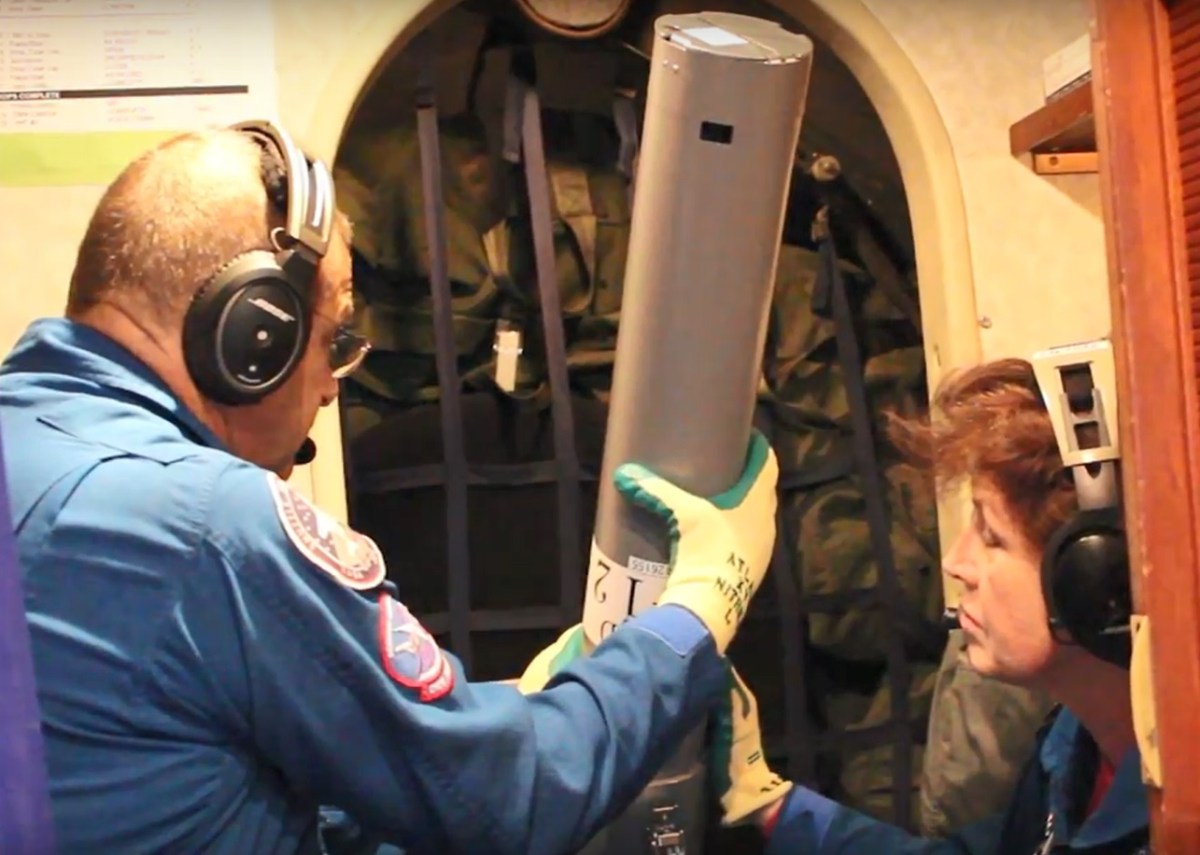
Despite racing against impending harsh weather conditions, a red and white World War II aircraft flew slowly and steadily over the icy waters surrounding Greenland in August and September. Three weeks delayed by pandemic restrictions, scientists from NASA’s Jet Propulsion Laboratory inside this retrofitted DC-3 plane started dropping hundreds of probes as part of an annual expedition known as the Oceans Melting Greenland (OMG) Project.

Since 2016, the OMG project has conducted numerous flights over the waters near Greenland’s lengthy and jagged coastline. They drop roughly 250 probes each year (though they managed a record 346 during this extraordinary 2020 expedition) which then relay temperature and salinity data. The team uses this information to help determine how much the surrounding ocean is contributing to Greenland’s ice melt.

“The glaciers are reacting very strongly to the ocean and we ignore that at our peril,” said JPL scientist and principal investigator Josh Willis. “The oceans have the potential to melt the ice very quickly and drive the sea level rise even higher than we expected.”

If it all melted, Greenland’s ice could contribute as much as 25 feet of sea level rise—though Willis assures us that this is not expected within the next year, or even the next 100 years. The big question that his team is trying to help answer is rather the speed at which the ice is melting.

In the northwest of Greenland, where the Upernavik glacier meets the Atlantic. Credit: Josh Willis/JPL

Unlike icebergs—which float in water—glaciers sit atop a land mass, seemingly exposed and vulnerable to the warming atmosphere. While the atmosphere is a significant factor, it is not solely responsible for glacial melt. As the glaciers in Greenland start to ooze off the island in massive rivers of ice, they carve fjords into the landscape until they finally connect with the sea. While surface waters are generally frigid, the warmer ocean waters from below can cause the glacier to melt more quickly and speed up the amount of ice that drains off the land into the ocean.

Though the coronavirus pandemic had sweeping impacts across the globe, it didn’t halt environmental processes like Greenland’s glacial ice melt. It also didn’t impede the resolve of the OMG scientists to continue their work.

Starting in March up until the day they landed in Greenland on August 24, Willis says he wasn’t sure they would be able to collect their data this year. But cooperation between the various stakeholders, including NASA, the State Department, and the governments of Canada and Greenland, was key. Willis also gives credit to a huge amount of hard work by OMG’s Project Manager, Ian McCubbin of JPL, for making it possible. “If it wasn’t for McCubbin,” said Willis, “we’d still be sitting on our couches.”

Coordinating the scientists and equipment necessary for any expedition requires a great deal of planning, and the additional pandemic-related precautions made everything just a little bit more complicated.

“It was like a whole new layer, after you go across the border and go through customs and boarder control, now you also go through coronavirus screening,” Willis said.

Oceans Melting Greenland lead scientist Josh Willis getting tested for COVID-19 while in Greenland. Credit: Josh Willis/JPL

In addition to getting tested a whopping seven times, two of which took place before even stepping foot in Greenland, Willis and the other members of the OMG team were very cautious. There was an initial isolation period after landing on the island during which they could fortunately work on the plane and equipment preparation, wearing masks when traveling to and from the site and no contact with locals. Greenland has had very few cases of COVID, and doesn’t have enough hospitals to handle any outbreaks, so the team was especially conscious of limiting their interactions with people there.

One exception was communicating with the nurses conducting their COVID-19 tests. “It was quite an experience getting tested this many times,” said Willis, “but the most fun was actually with nurses in Greenland, who were very nice and asked about our mission, so we got to tell them about what OMG was doing—and I suspect they followed along the rest of our journey on social media.”

Though some legs of the scientists’ expedition were delayed or more challenging as a result, Willis says it was well worth the extra effort to ensure everyone’s safety.

The outcome turned out to be a banner year for the project, despite the late start. Instead of heading north at the beginning of the month, it was already well into August when Project Manager Ian McCubbin and the three scientists from JPL—Ian Fenty, Mike Wood, and Willis himself—were able to meet with their flight crew from Kenn Borek Air.

The crew after their successful season. In the photo from left to right: Josh Willis, OMG lead scientist; Mike Wood, OMG scientist; Linden Hoover, Kenn Borek co-pilot; Jim Haffey, Kenn Borek pilot; and Ian Fenty, OMG scientist. Not pictured are Gerald Cirtwell, Kenn Borek flight engineer, and Ian McCubbin, OMG project manager. Credit: Josh Willis/JPL

Once they were on the ground in Greenland, their main concern was for the conditions they might encounter once back in the air.

“Weather starts to get pretty rough in September, and very rough in October.” said Willis. Fortunately, they were able wrap up their surveys by mid-September, mostly dodging the snow, sleet and wind that might impede their ability to drop all of the probes. “It was a sprint to the finish line, but we were able to accomplish everything we wanted to do and more.”

In fact, the team encountered unusually good conditions in the north east parts of the island, where ice and fog usually prevent access. As a result, they measured some glaciers that had never been sampled before.

When the project first began in 2016, the scientists also flew a jet with a radar strapped on the bottom to measure big swaths of glaciers from above, but NASA’s ICESat-2, an Earth-observing satellite that measures the mass of ice sheets and glaciers down to the inch that launched in 2018, takes care of that part of the mission now.

More than 45 scientific papers have now been published based on OMG data, with several more in progress. Willis says that every new discovery reminds them that the oceans are more important than they ever thought possible.

This year they noted new observations of Greenland’s largest glacier Jakobshavn, which has been closely monitored since the start of the project in 2016. In the first couple of years, the water near Jakobshavn cooled by 2.7 degrees Fahrenheit (1.5 degrees C)—a whole lot for a block of ice according to Willis. That cooling slowed the melting of the glacier, which then started growing instead. But early this year warm water returned to Jakobshavn and the recent observations suggest it is now thinning once again.

The view of Greenland’s Jakobshavn glacier from the DC-3 plane which carries the Oceans Melting Greenland Project scientists Credit: Josh Willis/JPL
The view of Greenland’s Jakobshavn glacier from the DC-3 plane which carries the Oceans Melting Greenland Project scientists. Credit: Josh Willis/JPL

These continued discoveries from the project are very exciting for the scientists and organizations involved. Because of this, the OMG project has gotten approval to continue its research beyond the original end date, meaning that Willis and his crew will again be making their way back to Greenland next August, and this time hopefully without much delay.

On the Iceberg Highway

The research ship Sanna of the Greenland Institute of Natural Resources. Credits: NASA/JPL-Caltech

by Carol Rasmussen / NORTHWEST GREENLAND /

If you remember the movie Titanic, this looks like a terrible place for a cruise. But to a captain with a lifetime of experience navigating around Greenland, it was a safe passage. And to scientist Ian Fenty of NASA’s Jet Propulsion Laboratory in Pasadena, California, it was a great place for research.

Ian is a co-investigator for NASA’s Oceans Melting Greenland (OMG) campaign, a five-year project to measure the effects of ocean water on Greenland’s rapidly melting glaciers. In August, he was the sole OMG representative on a research cruise to glacier fronts in northwest Greenland. And where there are glaciers, there are icebergs.

Ian Fenty. Credits: NASA/JPL-Caltech

Through a professional connection with marine biologist Kristin Laidre of the University of Washington, Seattle, Ian had an opportunity to join the Greenland Institute of Natural Resources’ (GINR) week-long research cruise in northwestern Greenland. Malene Juul Simon of GINR’s Climate Division and Laidre planned the trip to deploy underwater acoustic instruments at glacier fronts — an important habitat for narwhals. These long-toothed Arctic whales navigate and hunt by making clicking sounds and listening to the echoes bouncing off nearby rocks or prey. The acoustic instruments pick up the narwhals’ sounds, documenting their activity at the glacier fronts.

The GINR instruments are attached to moorings—lines more than half a mile long, with a half-ton anchor at one end and the instruments and floats attached at intervals to the other end. Ian realized that adding OMG sensors of water temperature and salinity to the lines would produce a unique local dataset for OMG and benefit the narwhal research as well. The scientists agreed to collaborate, and Ian joined the team in Upernavik, Greenland, for an eight-day cruise.

Getting close to glacier fronts means encountering icebergs. Although Greenland’s bergs don’t match Antarctica’s for sheer size, the island’s fjords and shallow waters are littered with everything from modest lumps to tablelands that dwarf the 106-foot-long (32.3-meter-long) Sanna.

The view from Sanna’s bridge. Credits: NASA/JPL-Caltech

“The captain was an expert pilot, with decades of experience in this kind of ship,” Ian said. “It was mesmerizing to watch them navigate through a field of icebergs to get to the instrument sites. His concentration was really impressive.” The crew usually work on fishing trawlers that are at sea for weeks, often in much worse weather than the researchers encountered.

Once at a proposed site, the researchers had to decide whether a mooring could survive there for two years. “There were some places that looked good on paper, but when you got there, you could see that they were on the iceberg highway,” Ian said –meaning  a current carrying icebergs from a glacier’s calving front.

An iceberg can not only rip the line off the anchor, it can drag the entire mooring out to sea, anchor and all. One mooring from Southeast Greenland washed up in Scotland, almost 1,500 miles (2,400 kilometers) away.

If the planned site looked dicey, the researchers would look for a nearby spot protected by an island or other feature that was still close to the calving front and deep enough to be attractive to narwhals. When they had agreed on a new site, the researchers programmed their instruments, and the crew tied them on the line.

Then they dropped the whole assembly, surface end first, along a course about a kilometer long. When the anchor dropped, it pulled the line into the proper vertical orientation.

The ocean environment may have been wild, but the ship was civilized. The six researchers and six crew were supplied with wifi, meals to suit both Greenlandic and European tastes, wet and dry labs, and comfortable bunkrooms.

“I have to give a lot of credit to Kristen and Malene for organizing the team,” Ian said. “It was a fantastic experience to work with so many different researchers in related but different areas. Pick any random pair, and they would be explaining something new to each other. The camaraderie was great. We definitely were collectively more than the sum of our parts.”

Juul Simon (center) and fellow researchers. Credits: NASA/JPL-Caltech

Ian will return next summer to change batteries on his instruments. The moorings are equipped to help the researchers find them among next summer’s icebergs. “There’s a simple mechanism that sits just above the anchor and listens for a specific tone sequence,” Ian said. “When we come up in the ship, we play that song and boom! It lets go of the line, and the line comes up to the surface. The mooring has a satellite phone, and it sends its current coordinates to us by email.

“I’ll be getting email from my instrument. That’ll be a special day.”

“We Came Here to Work”: OMG in the Field

Kulusuk, Greenland. Credit: NASA/JPL-Caltech
Iceberg off the coast of Greenland. Credit: NASA/JPL-Caltech
Iceberg, Greenland. Credit: NASA/JPL-Caltech
Sled puppy, Greenland. Credit: NASA/JPL-Caltech
Sled dog puppy, Greenland. Credit: NASA/JPL-Caltech

By Carol Rasmussen / KULUSUK, GREENLAND /

Kulusuk Island is breathtakingly beautiful — a spectacular mountain backdrop, quaint village, turquoise icebergs, even adorable sled-dog puppies. But Oceans Melting Greenland Project Manager Steve Dinardo didn’t choose it as a base because of the scenery. “We came here to work,” he says.

Kulusuk is ideally located for surveying East Greenland, which the locals call the wild side of the island — even more remote and unpopulated than the west coast. But the weather changes quickly, and the little airport doesn’t have a hangar to protect the research plane. If you have any trouble here, you could be stuck for quite a while. Every day in the field is expensive, and winter is just around the corner.

So the five OMG team members push themselves to get as much done as possible each day.

To begin with, they fly as many hours as they legally can to collect data. After the plane lands, there are still hours of work ahead. The plane is fueled and checked over for the next flight, Steve looks at multiple weather forecasting models to create a forecast for Kulusuk and the probe-drop areas, and Principal Investigator Josh Willis comes up with science priorities to match the weather. Both may end up revising their plans multiple times before the next morning’s fly/no fly decision.

Left to right: Steve Dinardo (NASA's Jet Propulsion Laboratory), OMG project manager; Scott Farley and Andy Ferguson (Airtec, Inc.), pilots; Glenn Warren (Airtec, Inc.), aircraft engineer; Josh Willis (JPL), OMG principal investigator. Credit: NASA/JPL-Caltech
Left to right: Steve Dinardo (NASA’s Jet Propulsion Laboratory), OMG project manager; Scott Farley and Andy Ferguson (Airtec, Inc.), pilots; Glenn Warren (Airtec, Inc.), aircraft engineer; Josh Willis (JPL), OMG principal investigator. Credit: NASA/JPL-Caltech

Add to this list trying to stay in touch with family at home, answering a few pressing emails, eating, showering and so on. No wonder that some days, the team gets no more than a few glimpses of the incredible landscape out of plane and hotel windows.

“It’s more of an adventure in retrospect,” Josh summarized. “While you’re there, you have your head down and you’re working as hard as you can. When you get a day off, you sleep.”

The team has already had the one mandatory day off that it will get in Kulusuk. As far as I could tell, everyone filled it almost as full as the work days. At dinner, several team members did mention a nap, but they also spent some of their precious free time out in the Arctic landscape. Jakob Ipsen, manager of the Hotel Kulusuk, found a villager to take senior pilot Andy Ferguson fishing and another who took four of us to see a nearby glacier. Later, Jakob drove a few team members to the highest point on the island to watch the sunset.

Sunset over Kulusuk, Greenland. Credit: NASA/JPL-Caltech

The next morning, it was back to business. Steve gave a favorable weather forecast at 7 a.m., and the team took off for another eight-hour research flight about an hour later. They flew north to Scoresby Sund and dropped another 10 probes in key fjords, for a total of 99 drops in five days. Only 150 more to go.

Steve Dinardo gives the weather forecast during breakfast each morning. Credit: NASA/JPL-Caltech

A Majestic Glacier on OMG’s Return to Greenland

Apusiaajik Glacier near Kulusuk, Greenland. Credit NASA/JPL-Caltech

by Carol Rasmussen / KULUSUK, GREENLAND /

“Incredibly majestic.”

After years of intensive research on Greenland’s glaciers, Josh Willis is standing next to one for the first time in his life. Apusiaajik isn’t one of Greenland’s giants — in fact, its name means “little glacier.” But its marbled blue-and-white wall of ice is tall, long and, as Willis says, majestic.

It’s also melting. From time to time there’s a loud cracking noise, and seconds later, a few refrigerator-sized chunks of ice drop into the ocean. You can’t help wondering when a larger chunk will fall, and how much icy water will hit you when it does. It’s natural for glaciers to lose ice this way, though disconcerting when you’re in the neighborhood. But Apusiaajik is like most of Greenland’s glaciers, it’s out of balance — melting faster than it can be replenished by winter snowfall.

Josh Willis, OMG’s principal investigator, on approachby boat to Apusiaajik glacier in Greenland. Credit NASA/JPL-Caltech
Josh Willis, OMG’s principal investigator, on approach by boat to Apusiaajik glacier in Greenland. Credit NASA/JPL-Caltech

We’re visiting the little glacier on a down day for NASA’s Oceans Melting Greenland (OMG) campaign. It’s close to Kulusuk, a tiny village on Greenland’s east coast that happens to have an airport with a 4,000-foot-long gravel runway. That’s too short for a big jet to take off and land. But for OMG’s converted DC-3, the Kulusuk airport is perfectly located for the mission’s survey flights around southeastern Greenland, studying how ocean water is affecting glaciers like Apusiaajik.

OMG is on its third annual campaign out of a planned five. The goal each year is to blanket Greenland’s continental shelf with probes measuring the seawater’s temperature and salinity. This year, the team has already dropped 89 out of 250 probes, starting at the southern tip of Greenland and working up the east coast. Soon it’ll be time to move north to the next base.

Josh Willis after releasing an ocean probe down the white tube, where it drops from the plane into the ocean. Credit NASA/JPL-Caltech

Halfway through OMG’s expected lifespan, what have scientists learned, and what do they still hope to find out?

“We’re beginning to see the signs of long-term changes on Greenland’s continental shelf — changes that take years to happen,” Willis says. “We’ve never seen that before.” Daily changes in water temperature come and go, but the OMG scientists are finding that glaciers react more strongly to slow changes in water temperature far below the ocean surface.

Greenland’s continental shelf is shallow, averaging about 1,600 feet (500 meters) deep. But it’s gashed by troughs carved by ancient glaciers, which can be two times deeper than that. These troughs are natural conduits for deep water to get up on the shelf, but it’s not an easy passage. Sills and underwater mountains within the troughs impede the flow and create basins.

Willis gestures at the ice-flecked channel flowing past Apusiaajik. “In a couple of weeks, all this water will be way downstream,” he says. “In the troughs and basins on the shelf, that’s not true. They’re almost like tide pools — the water comes in at high tide and stays there till the tide comes back. In those deep basins, instead of twice per day like the tide, it’s more like once per year and sometimes less. And when warm or cold water gets in, it stays for years.” There’s not always enough variation in the seawater from winter or summer for water to get into the basins each year; it may take a change in a large-scale ocean climate pattern, similar to an El Niño event in the Pacific Ocean, to trigger the change.

For the last two years, the North Atlantic has been moving into a naturally cooler climate phase. Willis is eager to see when and how far the cooler water will move up the West Greenland coast, and how long it will last.

Answering those questions will chip away at the big remaining goal of OMG: quantifying how much glacial ice melt will result from any given change in ocean temperature. If water comes onto the continental shelf that’s a degree Celsius warmer than now, how much will the melt rate increase? What about three degrees?

Ice-filled channel in front of Apusiaajik Glacier. The surface ocean layer is much colder than the deep water below. Credit NASA/JPL-Caltech

“One of the advantages of watching a glacier change year after year after year is that you begin to get an idea of what’s driving the change. If it’s the ocean, I think we’ll be able to quantify that with two more years of OMG data,” Willis says.

“That’s what we set out to do. What I’m really excited about is that it’s beginning to happen.”

A Long Deployment, on Ice

Glaciers in northwest Greenland. Credit: NASA/JPL-Caltech

by Carol Rasmussen / KEFLAVIK, ICELAND /

“Svalbard was really nice. Thule was really cold. Kangerlussuaq was really small. We’re still trying to figure out what Iceland is really.”

That’s principal investigator Josh Willis’ capsule description of the Oceans Melting Greenland (OMG) campaign so far. Approaching the end of a month-long deployment in the Arctic, the team members are pacing themselves to finish their mission without running out of energy, patience or clean socks. It’s been a marathon campaign, relocating to a new base every few days, each one in a different time zone.

But there are compensations. Even the been-everywhere, seen-everything crew of the NASA G-III has been impressed by the spectacular Arctic scenery.

The ocean near Thule. Credit: NASA/JPL-Caltech

Few people on Earth have seen as much of the Greenland coast as this team. It’s a dramatic coastline scored with hundreds of fjords. Many contain glaciers—the places where warm subsurface ocean waters may have a chance to melt Greenland’s ice from below. Behind the fjords is a jumble of rock, snow and ice, and in front is ice and water. The OMG crew has now dropped about 180 of its planned 250 probes in open water within fjords, along the coastline and out onto the continental shelf.

The front of a Greenland glacier flowing into the ocean. Credit: NASA/JPL-Caltech

The team has been operating out of four bases: Thule, in northwest Greenland; Kangerlussuaq, in southwest Greenland; the island of Svalbard, Norway; and their current location in Keflavik, Iceland. The bases allow them to stay close to whatever part of the coast they’re measuring rather than wasting fuel flying for hours across the huge island from a single base. Each base is in a different time zone, and the farthest jump is five hours’ difference.

What about jetlag?

“With so many time changes, I don’t try to adapt,” said flight engineer Phil Vaughn. “I sleep when I’m sleepy.”

Thule Air Base after a storm. Credit: NASA/JPL-Caltech

Blizzard season starts in mid-September in cold Thule. This being an air base, storms are ranked using the air controller’s alphabet: Alpha, Bravo, Charlie or Delta. One night, the OMG crew watched conditions deteriorate to Charlie—complete lockdown. “The winds blow snow from the local icecaps so thick that it decreases visibility and it’s dangerous to be outside,” Willis said. “You don’t go outside at all. We used the time to get a little bit of outside work done and answer emails.” The storm lasted about 20 hours.

Having that much time for anything but work was something of a luxury on a field campaign. The crew is required to take a “hard down” day after every six flight days, giving them a chance to catch up on sleep or chores. But in a new location, one day may not be enough to find fresh produce, do laundry or pick up supplies that have run out. Hotels offer most of these services, but the fee can be hefty. One crew member grumbled that he was charged $90 for a small load of laundry at an earlier stop.

When I asked what happens if someone gets sick, the crew just looked at me. Finally, flight engineer Terry Lee said, “You try to stay away from the other people.” That’s not physically possible in a small plane. But staying home isn’t an option either.

Aurora borealis at Keflavik, Iceland, on Sept. 29. Some of the team saw their first northern lights on this tour. Credit: NASA

OMG’s mission success makes up for a lot of inconveniences, though. After weeks of practice and with the keen eyes of the pilots, Willis and the team have gotten very good at finding alternate drop locations in thick ice or cloud cover. Engineers Lee and Vaughn have become expert marksmen at hitting small patches of water. And though the scenery is undeniably jaw-dropping, Willis’ favorite sight from the entire trip is something quite different. “After we dropped one probe, we did a very steep bank and started to climb. I looked over my shoulder and saw a tiny splash. I think that was our probe hitting the water.”

Teamwork Makes for a Dream Team

Josh Willis and Steve Dinardo celebrate a successful probe drop. Credit: NASA

by Carol Rasmussen / KEFLAVIK, ICELAND /

The first thing you notice about the Oceans Melting Greenland (OMG) crew is the shared memories. “Where did we get that great pizza—Thule?”

“No, at the little restaurant in Svalbard, remember?”

The next is a story that begins “When we were in . . . ” could continue anywhere: Kazakhstan, Alaska or the Middle East. This is a team that has been working together well for a long time, in more far-flung locations than most world travelers even dream of.

The OMG crew is a textbook example of a high-performance team: a group with diverse and complementary expertise, well-defined jobs, ambitious goals and a strong commitment to the mission and to each other. On their arrival in Iceland, the group consisted of two mechanics/ground crew, two pilots, three flight engineers, the project manager and the principal investigator. A few people have swapped in and out since then, but each team member has distinct responsibilities, and each is essential to keep the mission running. “It’s been a great team effort here,” summarized flight engineer Phil Vaughn. “We’ve got the coordination down to a real good point where everybody knows what each other is doing.”

Johnny Davis (left) and Dave Fuller take inventory on arrival in Iceland. Credit: NASA
Johnny Scott (left) and Dave Fuller take inventory on arrival in Iceland. Credit: NASA

Johnny Scott and Dave Fuller are the ground crew, responsible for preflight and postflight checks and routine maintenance. Scott has worked on the NASA G-III for eight or nine years. The preflight check, which takes an hour or more for the two crew members, includes a walkaround where they simply apply their trained eyes to the aircraft inside and out. “After you’ve looked at the airplane so long, you’ll catch things fast,” Scott said. “You’ll say, ‘Hey, that’s not right.’ You’ll investigate. Most of the time you don’t find anything [significant], but you might find a leak or a crack, or something out of place.”

Arctic cold hasn’t added a lot of additional maintenance chores, Fuller said, because the planes are in heated hangars at their bases. The main difference Is air pressure. Just as you change your car’s tire pressure in winter in a cold climate, the plane systems also need to change. It’s not just tires: it’s things like the brake accumulator pressure—the reserve air needed for emergency brakes. “If the conditions are set correctly on the ground, then the plane will be fine while flying,” he explained.

Pilot Bill Ehrenstrom. Credit: NASA/JPL-Caltech

Flying is the business of the pilots, and so are all the concerns that go with it—weather, flight plans, fuel management and a multitude of details. Bill Ehrenstrom is the pilot in charge. He and Scott Reagan have flown so many hours over Greenland already that they were concerned they would hit the 30-day limit of 100 hours, so they were joined in Iceland by Chris Condon. “We’ve been lucky to see things that a lot of people don’t ever get to see,” Ehrenstrom said about flying all those hours. “But the weather has been a challenge. We haven’t been able to drop probes in some place because of the weather, and it hasn’t always been the greatest at the sites.”

All three pilots had former careers in the military, and Reagan is planning to undertake a third career soon that some people would find even more intimidating than his first two: teaching high school history or physics.

Flight engineer Terry Lee and pilot Scott Reagan have been working together since the mid-1990s. Credit: NASA

“Never in my life did I think I’d get to drop things out of the airplane when we were out flying,” said flight engineer Vaughn. A flight engineer is responsible knowing all the plane’s electrical and computer systems and monitoring them during the flights, as well as supporting the pilots.  On top of that, it’s safe to say that Vaughn and Terry Lee are the world’s experts on dropping probes out of a G-III—this is the first experiment ever to do such a thing, and the aircraft had to be specifically modified to allow it. “It’s kind of a rush,” Lee said.

Flight engineer Phil Vaughn. Credit: NASA

“Project manager” sounds like a desk job, but not on a NASA field project. Steve Dinardo doesn’t just track expenses; he tracks probe data at the airborne computer as well as shipboard operations in support of OMG and myriad other details. “To get this to all hang together and work sometimes is a miracle,” he said. Dinardo started at NASA working on space missions. “Aircraft projects are a lot more fun than spacecraft and a lot more challenging. I get to see the whole project from Step 1 to Step 100. That’s something you don’t get with spacecraft.”

The team relaxes in the plane during a lengthy transit flight. Credit: NASA/JPL-Caltech

The last team member is principal investigator Willis. OMG is his brain child, and he’s responsible for overall execution, as well as helping with science-related decisions in the field such as choosing good alternate sites for probe drops if the original choice is too iced in. Willis has integrated well with the rest of the crew, and he’s thrilled with their work. “I couldn’t have asked for a better team to support this mission,” he said. “It’s been a spectacular ride.”

Bullseye! The Hunt for Open Arctic Water

by Carol Rasmussen / KEFLAVIK, ICELAND /

The Oceans Melting Greenland science team carefully planned each location for the team to drop its ocean probes. Some sites are in narrow fjords; others are hundreds of miles out on the continental shelf. Each site was chosen to add value to the data the team is collecting.

The two biggest enemies of this planning are ice and weather.

Sea ice is at its lowest at this time of year, but there’s plenty of it around Greenland, especially in the north. The probes can’t punch through it to reach the water below. If a drop site is ice covered, the team looks for a location that is “close by and second best,” said principal investigator Josh Willis.  They might need to go to the next fjord over or a bit farther out on the shelf. Since no data whatsoever have been collected from much of the northern coastline, these alternatives have value too.

A perfect drop site, viewed through the tube where the ocean probes are dropped. Credit: NASA/Charlie Marshik
Ice in northern Greenland led to some frustrating days for probe drops. This fjord almost completely choked by ice was one of the unsuccessful probe drop sites, shown as orange pins on the map (below). Green pins indicate successful drops. Credit: NASA/JPL-Caltech

_OMG_Josh Willis_Svarbard-Norway_ Orange NoGo-Green Go IMG_7690

Project manager Steve Dinardo has been working on airborne projects for 38 years. “Weather is always the problem. When you don’t want clouds, you get clouds. When you want clouds, you don’t get them,” he said.

OMG doesn’t want clouds. If the team can’t see the ocean, they can’t risk hitting a ship or whale by blindly dropping a probe. “We’re always looking for places where we can get a lot of work done in a short period of time,” Willis said. “If we fly in a region where the clouds are low and we can’t see the water through them, those can be really frustrating days.”

Turbulence can be a problem as well. To prepare and drop the probes, team members have to move around the cabin, not sit with the seatbelts securely fastened like commercial airline passengers.

It's not possible to drop probes in cloud cover like this. Credit: NASA/JPL-Caltech
It’s not possible to drop probes in cloud cover like this. Credit: NASA/JPL-Caltech

On the windy flight of Oct. 1, Dinardo was sitting at the computer to read the probe data.  “We were getting pretty hammered in the back,” he said. “Between me vibrating up and down and the keyboard vibrating up and down, I hit a number-lock key on the keyboard. The computer froze and I had to reboot it.” Despite that mishap, it was a successful day, with 14 probes dropped and returning signals.

Over the weeks of the mission, the team has gained skill at hitting small targets, Willis said. “We got really lucky one day when we were operating out of Svalbard, Norway. On a day when we were particularly frustrated by ice, we found a gigantic iceberg pushing through a huge area of sea ice, leaving a small wake behind it. The team amazingly bullseye’d the wake, dropping an ocean probe right through the water on the backside of the iceberg. It was a shining moment when the team showed we could hit a very small target from an aircraft traveling 200 knots.”

Flight engineer Terry Lee prepares to drop a probe. Credit: NASA

Today, however, weather is keeping the team on the ground. For several days, Dinardo and senior pilot Bill Ehrenstrom have been watching a forecast storm approach from the south. Today, it finally arrived. The crew was grounded by clouds and gusty winds over Greenland. Tomorrow doesn’t look any better, with the forecast calling for gusts up to 55 miles per hour.

“I think we have at least one more day before we have any chance of flying,” Ehrenstrom said, though he won’t make the final call till tomorrow morning.


Taking the Ocean’s Temperature Around Greenland

by Carol Rasmussen / KEFLAVIK, ICELAND /

SCENIC

Over the last three weeks, the Oceans Melting Greenland team has spent many hours flying over spectacular Arctic scenery. Fjords, glaciers, icebergs, the northern lights — they’ve seen enough sights to fill a guidebook. But the most compelling view, the view they came all the way north to see, is on a computer screen inside the plane.

OMG is in the field this fall to do one thing 250 times: drop ocean probes from an airplane around the entire coast of Greenland and read its measurements of ocean temperature and salinity. Relayed to the airborne computer, the data from the probes shows where warm, highly salty, subsurface Atlantic water is able to reach the bottoms of glaciers along the coast.

The computer on NASA's G-III aircraft shows an ocean probe's measurements as it sinks through the water near the Greenland coast. The water is warmest and saltiest near the surface.
The computer on NASA’s G-III aircraft shows an ocean probe’s measurements as it sinks through the water near the Greenland coast. The water is warmest and saltiest near the surface.

This water is warm only in comparison with the polar runoff that forms the surface layer, but its extra 6-8 degrees Fahrenheit (3-4 degrees C) makes it plenty warm enough to melt glacial ice. The polar water can be as cold as 4 degrees below freezing Fahrenheit (-2 degrees C). At those temperatures it doesn’t melt ice at all.

On 13 research flights since Sept. 13, the team has dropped 163 of the probes around all of Greenland except the southeast coast. They’ll pepper that coastline with the remaining probes from their new location in Keflavik, Iceland.

Flight engineers Phil Vaughn and Terry Lee (NASA Johnson Spaceflight Center) drop a probe on target. Credit: NASA

In the last year or two, various research teams have done seafloor surveys of a few Greenland glaciers and found deep gashes on the edge of the continental shelf where subsurface warm water can creep up on the shelf and melt the glaciers more quickly than the colder shallower water. But these few locations to the whole coastline would be risky business. Willis says that when they began the survey in mid-September, “I didn’t know what to expect. We knew that Atlantic water was getting into a few of these fjords, but the shelf has not been measured extensively before, and satellite data won’t tell you if warm, salty Atlantic water is there because it’s so far below the surface. You have to go drop a temperature sensor in the water.”

The probes relay their measurements in real time to the airborne computer, so the OMG team got views of subsurface conditions starting with the very first drop. As the measurements kept rolling in, the view from the computer screen became more and more disturbing.

OMG project manager Steve Dinardo (NASA Jet Propulsion Laboratory) at the airborne computer that collects the probe data. Credit: NASA

“Very soon, it became clear that there was a good deal of warm water on the shelf — not just in the fjords but spread out. As we mapped farther and farther north, we could see more warm water on the shelf. Now we’ve sampled [most of] the continental shelf, and everywhere that it’s deep enough, there seems to be Atlantic water present,” Willis said.

It’s unlikely that the southeast section will contain surprises, he added, because scientists already know that glaciers in this sector are melting very quickly and ocean warming is evident on the surface.

Willis emphasizes this is only a first impression from watching the data on screen. However, he pointed out, “Every time we make a discovery about ice melt in Greenland, we find the picture is worse than we thought it was before. I don’t think this will be any exception.”

AN ARCTIC PORFOLIO

Crew members of NASA’s Oceans Melting Greenland mission have seen extraordinary sights during their latest deployment, both from the plane and at their four bases. Here are a few highlights.


OMG: We’ve Returned to Greenland!

NASA's probe-dropping Gulfstream-III aircraft at sunrise in Thule, Greenland. Credit: NASA/Bill Ehrenstrom
NASA’s probe-dropping Gulfstream-III aircraft at sunrise in Thule, Greenland. Credit: NASA/Bill Ehrenstrom

by CAROL RASMUSSEN 

NASA’s Ocean Melting Greenland, or OMG, campaign is back in the Arctic, and this month it’s dropping scientific probes out of a NASA aircraft into the water just off Greenland’s coastline. The probes are the fourth and final part of OMG’s observations this year documenting how seawater is melting the underside of the world’s second largest ice sheet.

Three things about Greenland: it’s huge, it’s remote, and it’s melting so fast that scientists use words like “falling apart” and “vanishing” to describe what they’re seeing. But the hugeness and remoteness mean that many parts of the island have gone completely unmeasured. There aren’t enough data for scientists to be confident that they understand how processes are interacting now, much less how the melting will progress in coming years.

“It’s hard to predict what’s going to happen to Greenland because we’ve never watched it melt before,” said Josh Willis, OMG’s principal investigator with NASA’s Jet Propulsion Laboratory, Pasadena, California. The measurements OMG is making this month, and over the next four Septembers, should reduce some of the uncertainty.

The OMG team, left to right: Flight engineer Phil Vaughn, pilot Scott Reagan, engineer Johnny Scott, engineer Charlie Marshik, principal investigator Josh Willis, flight engineer Terry Lee, engineer Dave Fuller, project manager Steve Dinardo and pilot Bill Ehrenstrom. Willis and Dinardo are from JPL, the rest of the team from NASA's Johnson Spaceflight Center.
The OMG team, left to right: Flight engineer Phil Vaughn, pilot Scott Reagan, engineer Johnny Scott, engineer Charlie Marshik, principal investigator Josh Willis, flight engineer Terry Lee, engineer Dave Fuller, project manager Steve Dinardo and pilot Bill Ehrenstrom. Willis and Dinardo are from JPL, the rest of the team from NASA’s Johnson Spaceflight Center.

To collect data around Greenland’s entire coastline, the OMG team is using four bases. Slice two imaginary lines across the island, one north-south and the other east-west, and there’s a different OMG base for each quarter, more or less. The bases for measuring the west side of the island are on Greenland itself; for the east side, the bases are in Iceland and on the Norwegian island of Svalbard.

OMG isn’t moving methodically around the island. It’s spending a few days in one location and then another, sometimes doubling back to the first location, as logistics and weather dictate. An Earth Expeditions reporting team will catch up with the team in a few days from Iceland. For now, here are some images from the field, captured by the team members themselves.

Loosely packed sea ice in front of Store Glacier. Credit: NASA/JPL-Caltech

Willis and the other OMG scientists timed this campaign to coincide with the Arctic sea ice minimum (conditionally announced on Sept. 10) so they would have the best chance of finding open water to drop probes into. But even at minimum, there’s still plenty of ice around Greenland. In loosely packed ice like this, dropping probes has been no problem. But in other locations, the water is almost completely covered with big plates of ice separated by narrow cracks, testing the team’s ability to hit their open-water targets. Some areas are completely ice-covered, with no possibility for dropping probes.

Cloud deck over Greenland. Credit: NASA/JPL-Caltech

If you want to drop probes along the coast, you need to be able to see the coast. The weather doesn’t always cooperate. On this day, no data were successfully collected.

Caption: The first probe dropped by OMG, signed by the entire crew. Credit: NASA/JPL-Caltech
The first probe dropped by OMG, signed by the entire crew. Credit: NASA/JPL-Caltech

The probes are similar to those dropped by hurricane hunters to monitor the ocean during storms. There’s a parachute to waft the package safely to the ocean surface. When it hits the water, a float inflates to hold up a radio transmitter. A sensor, tethered to the transmitter by wire, sinks some 3,000 feet (if the water is that deep), measuring water temperature and salinity on the way down. The transmitter relays these data back to the aircraft. OMG will drop about 250 of these probes by the end of its deployment in early October. Combined with maps of the seafloor shape around the coast that OMG is also producing, the probe measurements will give a picture of where warm, deeper water can creep onto the continental shelf and eat away at the glaciers fringing the ice sheet.

To read more about OMG in the field:

http://earthobservatory.nasa.gov/blogs/fromthefield/2016/09/21/swoosh/

Our Big Finish: Africa, Australia, Greenland

by Steve Cole / WASHINGTON, DC /

For the next month Earth Expeditions lives up to its name as we wrap up our reporting on NASA scientists in the field by taking you to three far-flung locations around the world. Our final trio of 2016 expeditions is exploring the edges of the Greenland ice sheet, potential climate changes in clouds off the Atlantic coast of Africa, and the condition of the Great Barrier Reef in Australia.

NASA photographer Jane Peterson on the tarmac in Walvis Bay, Namibia.

Our reporting team has just arrived in Walvis Bay, Namibia, for the start of the ORACLES airborne campaign looking into the complex interactions of tiny aerosol particles and clouds and their impact on climate. Two NASA aircraft are now at Walvis Bay for the mission, which will continue through the end of September. Our team begins blogging right here tomorrow!

Where there’s smoke there’s fire, but what if there are also cloud condensation nuclei? Clouds help to keep the planet cool by reflecting sunlight back into space. Aerosols such as smoke particles contribute by mixing with water vapor, resulting in “cloud seeds” that, in addition to forming raindrops, create brighter and more reflective clouds. On the flipside, smoke particles can absorb sunlight and contribute to atmospheric warming.

ORACLES mapThe ORACLES (Observations of Aerosols above Clouds and Their Interactions) campaign takes to the skies of the southern Atlantic to investigate this cloud-aerosol phenomena. “Aerosols work as a sort of a sun-umbrella,” said ORACLES principal investigator Jens Redemann. “Whether they’re absorbing or not, they have implications for clouds and cloud formations.”

In mid-September another NASA reporting team will be traveling with the Coral Reef Airborne Laboratory (CORAL) mission to the land down under to probe portions of the Great Barrier Reef.  CORAL is looking at the interplay of factors that influence these complex underwater ecosystems.

CORAL map

To date coral reefs have primarily been studied with scuba gear and a tape measure as the dominant tools of the trade. But CORAL will investigate reefs en masse with the use of an airborne instrument to record the spectra of light reflected upward from the ocean. Those measurements allow researchers to pick out the unique spectral signatures of living corals, sand and algae as well as create ecosystem-scale models of reef conditions.

The Earth Expeditions team will be reporting from Cairns, North Queensland – the gateway to the Great Barrier Reef – and Heron and Lizard Islands. CORAL will sample six sections across the length of the reef, from the Capricorn-Bunker Group in the south to the Torres Strait in the north.

“CORAL is a unique opportunity to obtain a large uniform data set across several reef systems. This will give us a whole new perspective on coral reefs,” said Eric Hochberg, CORAL principal investigator. Future field work of the three-year field campaign will inspect coral reefs in Hawaii and the Micronesian islands of Palau and the Mariana Islands.

OMG map

On the opposite side of the globe from Australia, the Oceans Melting Greenland (OMG) campaign will be dropping some 250 probes from a NASA aircraft into the waters on Greenland’s continental shelf and in its fjords. The probes measure ocean temperature and salinity as they sink thousands of feet into the water, transmitting the data to the aircraft above. Combined with OMG’s new maps of the seafloor along the coast, the probe data will show where warm, subsurface waters can come in contact with the undersides of glaciers and melt them from below.

The rate of underwater melting in Greenland has been one of the greatest uncertainties in predicting future sea level rise, according to Josh Willis, OMG’s principal investigator. With the intensive measurements that OMG will gather in its five-year span, “We may not solve the problem of predicting sea level rise, but we hope to make a dent,” he said.

To reach all of Greenland’s coastline — which is eight times the length of the U.S. East and West coasts combined — the OMG team will use four different bases in Greenland, Iceland and Norway between mid-September and early October. Our Earth Expeditions reporting team will document OMG’s work as winter approaches in the Far North.