On March 9, the international Surface Water and Ocean Topography (SWOT) satellite’s main scientific instrument – the Ka-band Radar Interferometer (KaRIn) – returned to regular commissioning activities.
KaRIn was shut off in late January. Since then, the team has worked to analyze the situation and developed a plan to restore operations utilizing a backup KaRIn power unit. The backup unit was chosen to expedite the restoration of operations and to minimize overall risk to the mission.
The mission continues to monitor KaRIn, as well as overall operations, as it progresses with commissioning, calibration, and validation activities to ensure the performance of SWOT’s systems and science instruments in preparation for the planned start of science operations in July 2023.
After launching in December 2022, the international Surface Water and Ocean Topography (SWOT) mission started commissioning activities – the six-month checkout period before the scientific mission begins. Commissioning has included turning on all the science instruments, among them the main science instrument, the Ka-band Radar Interferometer (KaRIn), which engineers fully powered on in mid-January 2023. They received performance information, but in late January one of the instrument’s subsystems – the high-power amplifier – was unexpectedly shut down.
Engineers are working systematically to understand the situation and to restore operations, performing diagnostics and working with a test bed that simulates the KaRIn instrument on Earth. Once the KaRIn instrument is up and running again, the mission will continue with its commissioning and calibration activities – planned March through June – to ensure data accuracy in preparation for the beginning of science operations in July 2023.
Launched from Vandenberg Space Force Base in California, SWOT is a collaboration between NASA and the French space agency Centre National d’Études Spatiales, with contributions from the Canadian Space Agency and the UK Space Agency. SWOT will take high-resolution measurements of the height of water in the world’s oceans and freshwater bodies. It will provide insight into the ocean’s role in climate change and help communities monitor and plan for changes in water resources and the effects of rising seas.
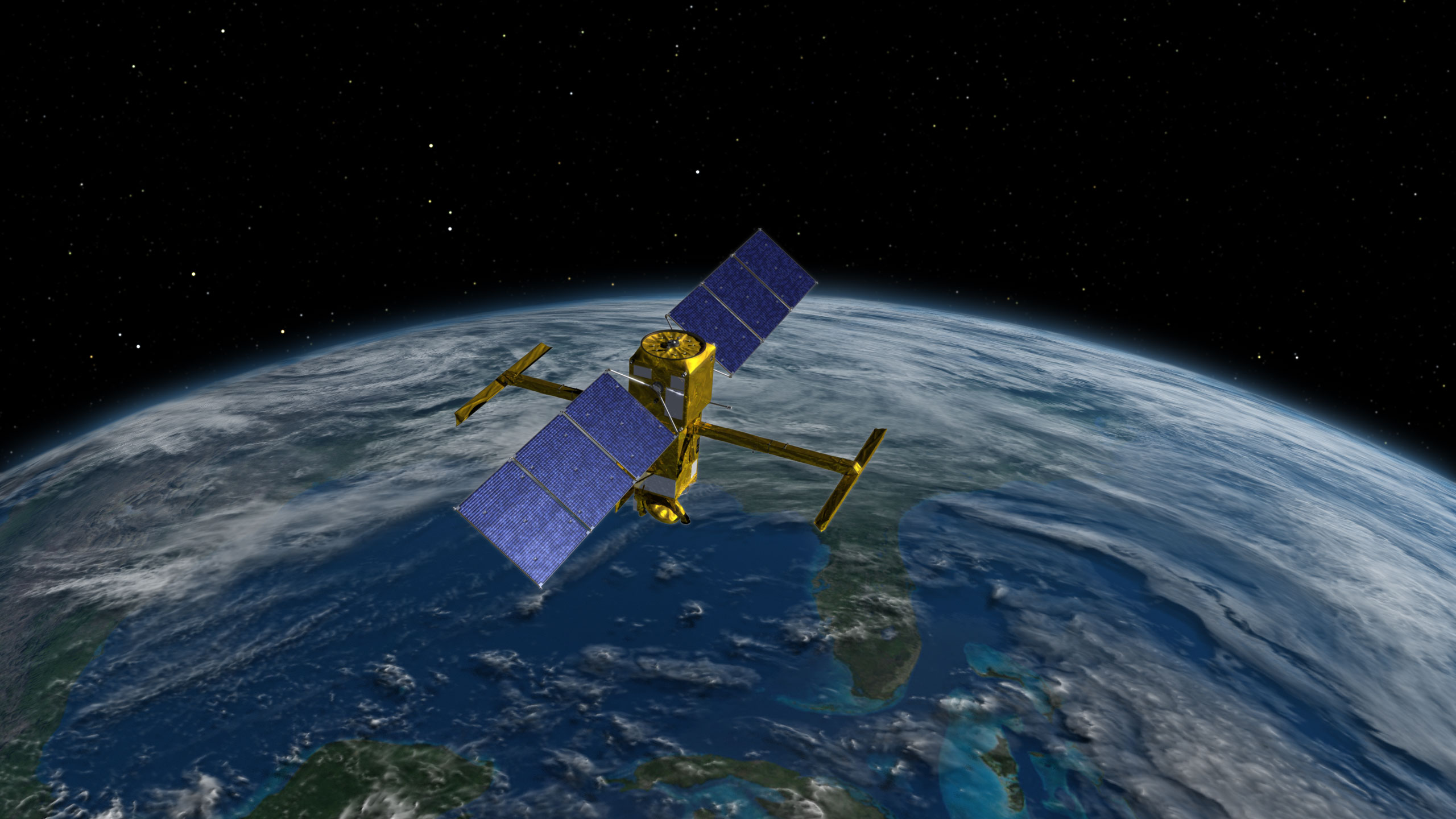
An artist’s concept of the Surface Water and Ocean Topography (SWOT) spacecraft. The SWOT mission will measure the height of the world’s ocean, rivers, and lakes, helping scientists to measure how fresh and saltwater bodies change over time. Credits: NASA
SWOT has successfully made contact with ground stations here on Earth and is providing teams with early data on the spacecraft’s health.
A collaboration between NASA and the French space agency Centre National d’Études Spatiales (CNES), with contributions from the Canadian Space Agency (CSA) and the UK Space Agency, SWOT will provide high-resolution measurements of the height of water in the world’s ocean and freshwater bodies, providing information on the ocean’s surface topography in great detail and measuring how bodies of water change over time. The instruments on board will provide insight into the ocean’s role in climate change, as well as help communities monitor and plan for changes in water resources and the effects of rising seas.
To stay connected with the mission, visit us on Twitter, Facebook, and Instagram and let others know you’re following it using the hashtag #TrackingWorldWater and tagging these accounts:
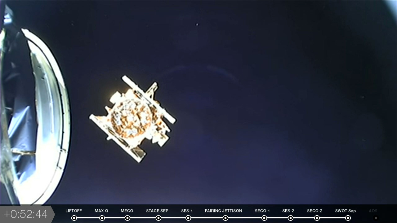
The Surface Water and Ocean Topography (SWOT) satellite separates from the SpaceX Falcon 9 rocket’s second stage, beginning the first mission dedicated to observing nearly all water on the Earth’s surface. Photo credit: NASA
The Surface Water and Ocean Topography (SWOT) spacecraft has separated from the Falcon 9 rocket’s second stage, beginning the first mission dedicated to surveying nearly all water on Earth’s surface.
Teams expect to receive a signal from SWOT in the next 30 minutes – stay with us here on the blog as we’ll confirm when that call comes through.
Watch the spacecraft separate from the Falcon 9 rocket’s second stage in the video below:
The Falcon 9’s second stage engine restarted for a short, six-second burn, and we have another successful second engine cutoff. Coming up next, in just under 10 minutes, the Surface Water and Ocean Topography (SWOT) satellite will separate from the rocket.
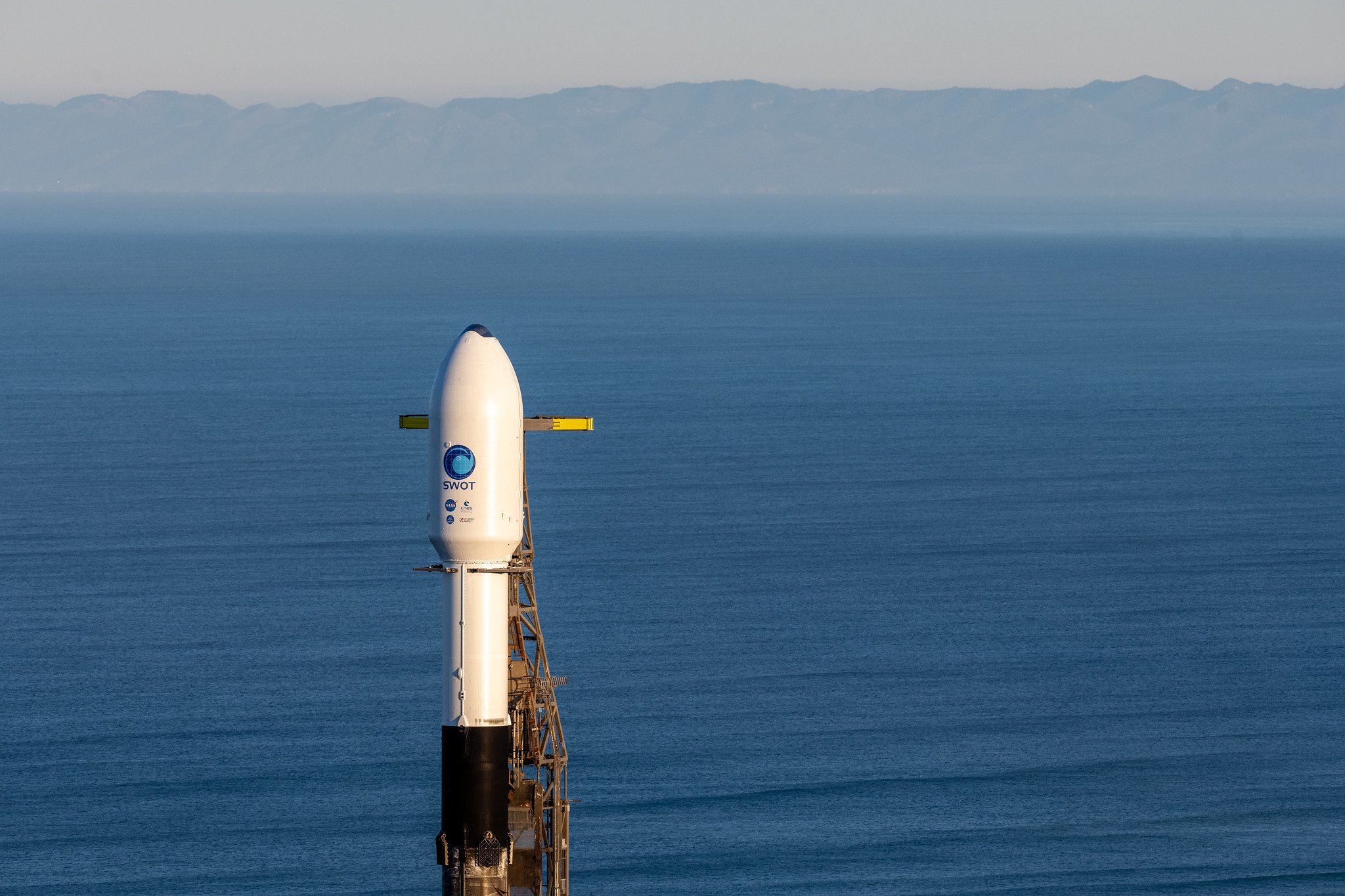
A SpaceX Falcon 9 rocket with the Surface Water and Ocean Topography (SWOT) spacecraft onboard is seen Wednesday, Dec. 14, 2022, at Space Launch Complex 4E at Vandenberg Space Force Base in California. SWOT lifted off at 3:46 a.m. PST on Dec. 16, 2022. Photo Credit: NASA/Keegan Barber
While we wait for that second stage engine to restart, take a look at a few fun facts about today’s Surface Water and Ocean Topography (SWOT) mission:
SWOT is the fourth Launch Services Program (LSP) science mission to launch from Vandenberg Space Force Base in California on a SpaceX Falcon 9
SWOT is LSP’s 101st primary mission
SWOT is the third LSP mission to fly a previously flown Falcon 9 booster
The satellite can see lakes down to 250 meters by 250 meters (approximately 820 feet by 820 feet) – about the size of three New York City blocks
This will be the sixth overall LSP science mission to fly on a Falcon 9 (previous missions include Jason 3, Sentinel-6 Michael Freilich, Transiting Exoplanet Survey Satellite [TESS], Double Asteroid Redirection Test [DART], and Imaging X-Ray Polarimetry Explorer [IXPE])
SWOT will observe the entire length of nearly all rivers wider than 100 meters (330 feet)
Stay with us here on the blog as we take you through some of the last major flight milestones, including spacecraft separation and signal acquisition.
The first stage of the SpaceX Falcon 9 rocket that launched the Surface Water and Ocean Topography (SWOT) satellite returns to landing zone 4 at Vandenberg Space Force Base in California on Dec. 16, 2022.
The SpaceX Falcon 9 rocket’s first stage has successfully landed at Vandenberg Space Force Base’s landing zone 4 in California. Meanwhile, the engine in the Falcon 9’s second stage has cut off.
The rocket’s upper stage and the spacecraft are now in a parking orbit, and in approximately 35 minutes, the engine will restart for a six-second burn.
The first stage of the SpaceX Falcon 9 rocket separates from the second stage after launching the Surface Water and Ocean Topography (SWOT) satellite from Vandenberg Space Force Base in California on Dec. 16, 2022. Photo credit: NASA
The SpaceX Falcon 9 rocket’s nine Merlin engines have finished their burn, and the first stage has separated from the rocket. As the second stage continues carrying the U.S.- and French-led Surface Water and Ocean Topography (SWOT) satellite on its journey, the rocket’s first stage will attempt a controlled landing at Vandenberg Space Force Base’s landing zone 4.
A SpaceX Falcon 9 rocket launches with the Surface Water and Ocean Topography (SWOT) spacecraft onboard, Friday, Dec. 16, 2022, from Space Launch Complex 4E at Vandenberg Space Force Base in California. Photo Credit: NASA/Keegan Barber
Ignition, and liftoff! At 3:46 a.m. PST, SpaceX’s Falcon 9 rocket blasted off from Vandenberg Space Force Base’s Space Launch Complex-4 East, carrying the first satellite to survey nearly all water on Earth’s surface.
Stay here on the blog as we take you through some key flight milestones, coming up in the next couple of minutes.
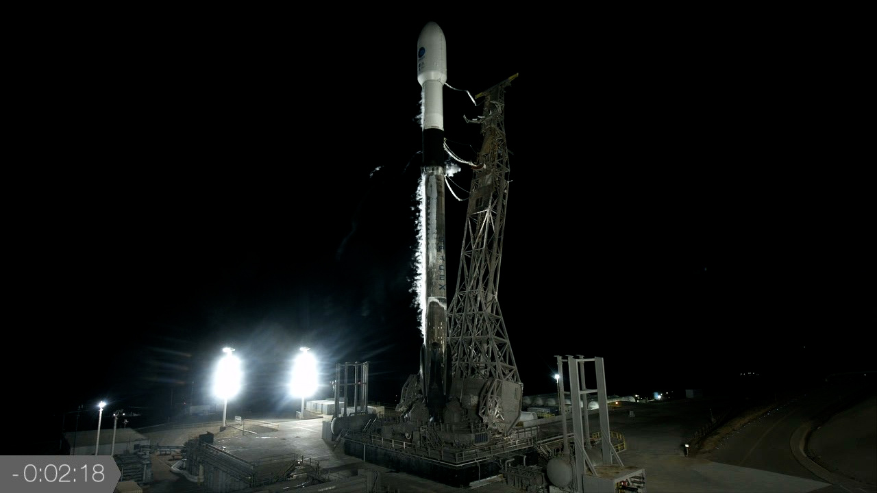
The SpaceX Falcon 9 rocket, with the Surface Water and Ocean Topography (SWOT) satellite atop, stands poised for liftoff at Space Launch Complex-4 East at Vandenberg Space Force Base in California on Dec. 16, 2022. Photo credit: NASA
NASA Launch Director Tim Dunn has just given the final “go” for launch of the international Surface Water and Ocean Topography (SWOT) satellite!
In the next few moments, the SpaceX Falcon 9 rocket’s nine Merlin engines will roar to life, sending SWOT on the start of its journey to survey nearly all water on Earth’s surface.